Weather Alert in Colorado
Fire Weather Watch issued February 14 at 9:48PM MST until February 17 at 8:00PM MST by NWS Denver CO
AREAS AFFECTED: North and Northeast Elbert County Below 6000 Feet/North Lincoln County; Washington County
DESCRIPTION: ...PROLONGED PERIOD OF CRITICAL FIRE WEATHER CONDITIONS SUNDAY THROUGH MID NEXT WEEK... ...EXTREMELY CRITICAL FIRE WEATHER CONDITIONS POSSIBLE TUESDAY... .Recent dry conditions combining with above normal temperatures and periods of gusty winds will bring potentially critical fire weather conditions Sunday and Monday to parts of the eastern Colorado Plains. Stronger, more widespread westerly winds are expected to develop Tuesday, possibly producing extremely critical fire weather conditions with wind gusts as high as 65 mph across the plains. * AFFECTED AREA...Fire Weather Zones 246 and 249. * TIMING...For the Red Flag Warning, from 11 AM to 5 PM MST Sunday. For the first Fire Weather Watch, from Monday morning through Monday afternoon. For the second Fire Weather Watch, from Tuesday morning through Tuesday evening. * WINDS...Southwest winds 15 to 25 mph with gusts u pto 40 mph Sunday and Monday. West winds 30 to 45 mph with gusts up to 65 mph on Tuesday. * RELATIVE HUMIDITY...As low as 11 percent each afternoon. * IMPACTS...Conditions will be favorable for rapid fire spread. Avoid outdoor burning and any activity that may produce a spark and start a wildfire.
INSTRUCTION: A Red Flag Warning means that critical fire weather conditions are either occurring now....or will shortly. A combination of strong winds...low relative humidity...and warm temperatures can contribute to extreme fire behavior. A Fire Weather Watch means that critical fire weather conditions are forecast to occur. Listen for later forecasts and possible Red Flag Warnings.
Want more detail? Get the Complete 7 Day and Night Detailed Forecast!
Current U.S. National Radar--Current
The Current National Weather Radar is shown below with a UTC Time (subtract 5 hours from UTC to get Eastern Time).

National Weather Forecast--Current
The Current National Weather Forecast and National Weather Map are shown below.

National Weather Forecast for Tomorrow
Tomorrow National Weather Forecast and Tomorrow National Weather Map are show below.

North America Water Vapor (Moisture)
This map shows recent moisture content over North America. Bright and colored areas show high moisture (ie, clouds); brown indicates very little moisture present; black indicates no moisture.

Weather Topic: What are Cumulonimbus Clouds?
Home - Education - Cloud Types - Cumulonimbus Clouds
 Next Topic: Cumulus Clouds
The final form taken by a growing cumulus cloud is the
cumulonimbus cloud, which is very tall and dense.
The tower of a cumulonimbus cloud can soar 23 km into the atmosphere, although
most commonly they stop growing at an altitude of 6 km.
Even small cumulonimbus clouds appear very large in comparison to other cloud types.
They can signal the approach of stormy weather, such as thunderstorms or blizzards.
Next Topic: Cumulus Clouds
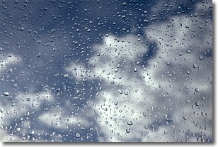
Weather Topic: What is Drizzle?
Home - Education - Precipitation - Drizzle
 Next Topic: Evaporation
Drizzle is precipitation in the form of water droplets which are
smaller than raindrops.
Drizzle is characterized by fine, gently falling droplets and typically does not
impact human habitation in a negative way. The exception to this is freezing drizzle,
a condition where drizzle freezes immediately upon reaching earth's surface.
Freezing drizzle is still less dangerous than freezing rain, but can
potentially result in hazardous road conditions.
Next Topic: Evaporation
Current conditions powered by WeatherAPI.com


