Weather Alert in Maryland
Cold Weather Advisory issued February 8 at 8:37PM EST until February 9 at 10:00AM EST by NWS Baltimore MD/Washington DC
AREAS AFFECTED: Extreme Western Allegany; Central and Eastern Allegany; Western Garrett; Eastern Garrett; Western Grant; Western Mineral; Eastern Mineral
DESCRIPTION: * WHAT...Cold wind chills of 10 below to 15 below zero expected on the ridges, with cold temperatures colder than 10 below zero possible in high elevation valleys. * WHERE...In Maryland, Central and Eastern Allegany, Eastern Garrett, Extreme Western Allegany, and Western Garrett Counties. In West Virginia, Eastern Mineral, Western Grant, and Western Mineral Counties. * WHEN...Until 10 AM EST Monday. * IMPACTS...The cold weather could result in hypothermia if precautions are not taken.
INSTRUCTION: Use caution while traveling outside. Wear appropriate clothing, a hat, and gloves. Keep pets indoors as much as possible. Make sure outdoor animals have a warm, dry shelter, food, and unfrozen water. Make frequent checks on older family, friends, and neighbors. Ensure portable heaters are used correctly. Do not use generators or grills inside. If you do not have heat in your home or lack shelter, you can call 211 or visit your local county or city Website for assistance locating appropriate shelter from the cold.
Want more detail? Get the Complete 7 Day and Night Detailed Forecast!
Current U.S. National Radar--Current
The Current National Weather Radar is shown below with a UTC Time (subtract 5 hours from UTC to get Eastern Time).

National Weather Forecast--Current
The Current National Weather Forecast and National Weather Map are shown below.

National Weather Forecast for Tomorrow
Tomorrow National Weather Forecast and Tomorrow National Weather Map are show below.

North America Water Vapor (Moisture)
This map shows recent moisture content over North America. Bright and colored areas show high moisture (ie, clouds); brown indicates very little moisture present; black indicates no moisture.

Weather Topic: What are Cumulonimbus Clouds?
Home - Education - Cloud Types - Cumulonimbus Clouds
 Next Topic: Cumulus Clouds
The final form taken by a growing cumulus cloud is the
cumulonimbus cloud, which is very tall and dense.
The tower of a cumulonimbus cloud can soar 23 km into the atmosphere, although
most commonly they stop growing at an altitude of 6 km.
Even small cumulonimbus clouds appear very large in comparison to other cloud types.
They can signal the approach of stormy weather, such as thunderstorms or blizzards.
Next Topic: Cumulus Clouds
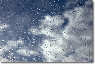
Weather Topic: What is Drizzle?
Home - Education - Precipitation - Drizzle
 Next Topic: Evaporation
Drizzle is precipitation in the form of water droplets which are
smaller than raindrops.
Drizzle is characterized by fine, gently falling droplets and typically does not
impact human habitation in a negative way. The exception to this is freezing drizzle,
a condition where drizzle freezes immediately upon reaching earth's surface.
Freezing drizzle is still less dangerous than freezing rain, but can
potentially result in hazardous road conditions.
Next Topic: Evaporation
Current conditions powered by WeatherAPI.com


