Weather Alert in Illinois
Flood Warning issued March 7 at 10:21PM EST until March 17 at 4:24AM EDT by NWS Indianapolis IN
AREAS AFFECTED: Edwards, IL; Gallatin, IL; Wabash, IL; White, IL; Gibson, IN; Knox, IN; Posey, IN
DESCRIPTION: ...The Flood Warning is extended for the following rivers in Indiana...Illinois... East Fork White River at Shoals, near Bedford, near Rivervale, at Williams, and at Seymour. Wabash River at Mount Carmel. ...The Flood Warning continues for the following rivers in Indiana... East Fork White River at Columbus. Driftwood River near Edinburgh. .Minor to moderate flooding continues on the main rivers south of Interstate 70 in central and southern Indiana as a result of 3 to 5 plus inches of rain falling during the past week. Upcoming rainfall Tuesday and Wednesday could extend the length of flooding. * WHAT...Minor flooding is forecast. * WHERE...Wabash River at Mount Carmel. * WHEN...Until Tuesday, March 17. * IMPACTS...At 22.9 feet, Water begins to flow over River Road just north of Fifth Street in the Mount Carmel area. * ADDITIONAL DETAILS... - At 9:45 PM EST Saturday /8:45 PM CST Saturday/ the stage was 18.9 feet. - Forecast...The river is expected to rise above flood stage late this evening to a crest of 23.2 feet Wednesday evening. It will then fall below flood stage Monday, March 16. - Flood stage is 19.0 feet. - http://www.weather.gov/safety/flood
INSTRUCTION: Turn around, don't drown when encountering flooded roads. Most flood deaths occur in vehicles. Be especially cautious at night when it is harder to recognize the dangers of flooding. Additional information is available at www.weather.gov/ind. The next statement should be issued Sunday afternoon by around 300 PM EDT /200 PM CDT/.
Want more detail? Get the Complete 7 Day and Night Detailed Forecast!
Current U.S. National Radar--Current
The Current National Weather Radar is shown below with a UTC Time (subtract 5 hours from UTC to get Eastern Time).

National Weather Forecast--Current
The Current National Weather Forecast and National Weather Map are shown below.

National Weather Forecast for Tomorrow
Tomorrow National Weather Forecast and Tomorrow National Weather Map are show below.

North America Water Vapor (Moisture)
This map shows recent moisture content over North America. Bright and colored areas show high moisture (ie, clouds); brown indicates very little moisture present; black indicates no moisture.

Weather Topic: What are Cumulus Clouds?
Home - Education - Cloud Types - Cumulus Clouds
 Next Topic: Drizzle
Cumulus clouds are fluffy and textured with rounded tops, and
may have flat bottoms. The border of a cumulus cloud
is clearly defined, and can have the appearance of cotton or cauliflower.
Cumulus clouds form at low altitudes (rarely above 2 km) but can grow very tall,
becoming cumulus congestus and possibly the even taller cumulonimbus clouds.
When cumulus clouds become taller, they have a greater chance of producing precipitation.
Next Topic: Drizzle
Weather Topic: What is Evaporation?
Home - Education - Precipitation - Evaporation
 Next Topic: Fog
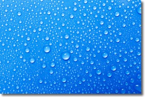
Evaporation is the process which returns water from the earth
back to the atmosphere, and is another crucial process in the water cycle.
Evaporation is the transformation of liquid into gas, and it happens because
molecules are excited by the application of energy and turn into vapor.
In order for water to evaporate it has to be on the surface of a body of water.
Next Topic: Fog
Current conditions powered by WeatherAPI.com


