Weather Alert in Minnesota
Winter Storm Watch issued February 15 at 2:32PM CST until February 19 at 12:00PM CST by NWS Duluth MN
AREAS AFFECTED: Koochiching; North St. Louis; Northern Cook/Northern Lake; North Itasca; Central St. Louis; North Cass; South Itasca; Northern Aitkin; Carlton/South St. Louis
DESCRIPTION: * WHAT...Heavy snow, patchy blowing snow, and mixed precipitation possible. There is a 50 to 90 percent chance for total snow accumulations in excess of 6 inches, highest for the higher terrain of the North Shore. There is also a 20 to 70 percent chance for at least a glaze of ice accumulations. Winds could gust as high as 35 mph. * WHERE...Northern Aitkin, Koochiching, North Cass, Itasca, Carlton, St. Louis, and Northern Cook and Lake Counties. This includes the Tribal Lands of the Fond du Lac Band, the Mille Lacs Band, Big Sandy Lake area and the Bois Forte Band, Nett Lake, Deer Creek and, Lake Vermilion areas. Other locations including Voyageurs National Park. The entire Boundary Waters is also included. * WHEN...From Tuesday evening through Thursday morning. * IMPACTS...Travel could be very difficult. The hazardous conditions could impact the Tuesday evening, Wednesday, and Thursday morning commutes. * ADDITIONAL DETAILS...Periods of gusty winds and visibility of less than one quarter mile are possible in the Winter Storm Watch area. The best potential for a wintry mix will be along and south of the Iron Range Tuesday evening into Wednesday morning.
INSTRUCTION: Monitor the latest forecasts for updates on this situation.
Want more detail? Get the Complete 7 Day and Night Detailed Forecast!
Current U.S. National Radar--Current
The Current National Weather Radar is shown below with a UTC Time (subtract 5 hours from UTC to get Eastern Time).

National Weather Forecast--Current
The Current National Weather Forecast and National Weather Map are shown below.

National Weather Forecast for Tomorrow
Tomorrow National Weather Forecast and Tomorrow National Weather Map are show below.

North America Water Vapor (Moisture)
This map shows recent moisture content over North America. Bright and colored areas show high moisture (ie, clouds); brown indicates very little moisture present; black indicates no moisture.

Weather Topic: What are Cumulonimbus Clouds?
Home - Education - Cloud Types - Cumulonimbus Clouds
 Next Topic: Cumulus Clouds
The final form taken by a growing cumulus cloud is the
cumulonimbus cloud, which is very tall and dense.
The tower of a cumulonimbus cloud can soar 23 km into the atmosphere, although
most commonly they stop growing at an altitude of 6 km.
Even small cumulonimbus clouds appear very large in comparison to other cloud types.
They can signal the approach of stormy weather, such as thunderstorms or blizzards.
Next Topic: Cumulus Clouds
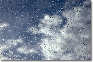
Weather Topic: What is Drizzle?
Home - Education - Precipitation - Drizzle
 Next Topic: Evaporation
Drizzle is precipitation in the form of water droplets which are
smaller than raindrops.
Drizzle is characterized by fine, gently falling droplets and typically does not
impact human habitation in a negative way. The exception to this is freezing drizzle,
a condition where drizzle freezes immediately upon reaching earth's surface.
Freezing drizzle is still less dangerous than freezing rain, but can
potentially result in hazardous road conditions.
Next Topic: Evaporation
Current conditions powered by WeatherAPI.com


