Weather Alert in New Mexico
Hydrologic Outlook issued August 27 at 1:54PM MDT by NWS Albuquerque NM
AREAS AFFECTED: Colfax, NM; Mora, NM; San Miguel, NM; Taos, NM
DESCRIPTION: ESFABQ Heightened Risk of River and Stream Flooding During Storm Events Through the Holiday Weekend. Repeated rounds of heavy rainfall in the area over the last several days have saturated the soils and raised the baseflow of rivers and streams in the area. We have reports of streams near the Mora, Sapello, Pecos and Vermejo river rising out of their banks, with additional reports of flowing water and debris across roads such as 518. These waterways will be extremely vulnerable to further rounds of precipitation, which we are expecting over the next week as a surge of deep monsoon moisture moves through the area. Expect further rises and impacts to nearby roads and low water crossings. Stay aware of any flash flood or river flood warnings that are issued. Exercise caution along riverbanks and watch out for potential mudslides across roads. For questions or comments about this outlook, you can contact Andrew Mangham, Senior Service Hydrologist, at 505-244-9150 x 228 or via e- mail at andrew.mangham@noaa.gov.
INSTRUCTION: N/A
Want more detail? Get the Complete 7 Day and Night Detailed Forecast!
Current U.S. National Radar--Current
The Current National Weather Radar is shown below with a UTC Time (subtract 5 hours from UTC to get Eastern Time).

National Weather Forecast--Current
The Current National Weather Forecast and National Weather Map are shown below.

National Weather Forecast for Tomorrow
Tomorrow National Weather Forecast and Tomorrow National Weather Map are show below.

North America Water Vapor (Moisture)
This map shows recent moisture content over North America. Bright and colored areas show high moisture (ie, clouds); brown indicates very little moisture present; black indicates no moisture.

Weather Topic: What are Cumulonimbus Clouds?
Home - Education - Cloud Types - Cumulonimbus Clouds
 Next Topic: Cumulus Clouds
The final form taken by a growing cumulus cloud is the
cumulonimbus cloud, which is very tall and dense.
The tower of a cumulonimbus cloud can soar 23 km into the atmosphere, although
most commonly they stop growing at an altitude of 6 km.
Even small cumulonimbus clouds appear very large in comparison to other cloud types.
They can signal the approach of stormy weather, such as thunderstorms or blizzards.
Next Topic: Cumulus Clouds
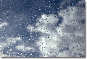
Weather Topic: What is Drizzle?
Home - Education - Precipitation - Drizzle
 Next Topic: Evaporation
Drizzle is precipitation in the form of water droplets which are
smaller than raindrops.
Drizzle is characterized by fine, gently falling droplets and typically does not
impact human habitation in a negative way. The exception to this is freezing drizzle,
a condition where drizzle freezes immediately upon reaching earth's surface.
Freezing drizzle is still less dangerous than freezing rain, but can
potentially result in hazardous road conditions.
Next Topic: Evaporation
Current conditions powered by WeatherAPI.com


