Weather Alert in Indiana
Flood Warning issued April 3 at 12:22AM EDT by NWS Northern Indiana
AREAS AFFECTED: Adams, IN; Allen, IN; Van Wert, OH
DESCRIPTION: ...The Flood Warning is extended for the following rivers in Indiana...Ohio... Eel River at North Manchester affecting Wabash, Whitley, Miami, Cass IN and Kosciusko Counties. Blanchard River at Ottawa affecting Putnam County. Maumee River at Napoleon affecting Henry County. Maumee River near Defiance affecting Henry and Defiance Counties. Saint Joseph River Ohio below Montpelier affecting Williams County. Saint Marys River near Decatur affecting Van Wert, Allen IN and Adams Counties. ...The Flood Warning continues for the following rivers in Indiana... Ohio... North Branch Elkhart River at Cosperville affecting Noble County. Tippecanoe River near Ora affecting Pulaski County. Tippecanoe River above Winamac affecting White, Pulaski and Carroll Counties. Yellow River at Plymouth affecting Marshall, Starke and St. Joseph Counties. Maumee River at Fort Wayne affecting Allen IN and Paulding Counties. Saint Joseph River Ohio near St. Joe River Ft. Wayne affecting Allen IN County. Saint Joseph River Ohio near Newville affecting Defiance, Allen IN and De Kalb Counties. Tiffin River at Stryker affecting Williams, Fulton OH and Defiance Counties. For the Tippecanoe River...including Ora, Winamac, Norway Dam... Moderate flooding is forecast. For the Eel River...including North Manchester...Minor flooding is forecast. For the Yellow River...including Plymouth, Knox...Minor flooding is forecast. For the Blanchard River...including Ottawa...Minor flooding is forecast. For the Maumee River...including Fort Wayne, Defiance, Napoleon... Minor flooding is forecast. For the Saint Joseph River Ohio...including Montpelier, Newville, St. Joe River Ft. Wayne...Moderate flooding is forecast. For the Saint Marys River...including Decatur, St. Mary's River near Fort Wayne...Minor flooding is forecast. For the Tiffin River...including Stryker...Minor flooding is forecast. For the Elkhart River...including Goshen, Cosperville...Minor flooding is forecast. * WHAT...Minor flooding is forecast. * WHERE...Saint Marys River near Decatur. * WHEN...From this morning until further notice. * IMPACTS...At 18.8 feet, Flood water begins to cross Ohio Highway 49 north of Willshire, Ohio. * ADDITIONAL DETAILS... - At 11:55 PM EDT Thursday the stage was 16.7 feet. - Forecast...The river will rise above flood stage this morning to 17.2 feet this evening. It will then fall just after midnight tonight. It will rise to 18.7 feet early Monday afternoon. It will then fall again but remain above flood stage. - Flood stage is 17.0 feet. - http://www.weather.gov/safety/flood
INSTRUCTION: Turn around, don't drown when encountering flooded roads. Most flood deaths occur in vehicles. Detailed river forecasts and additional information can be found at www.weather.gov/iwx under Rivers and Lakes. The next statement will be issued this evening at 630 PM EDT /530 PM CDT/.
Want more detail? Get the Complete 7 Day and Night Detailed Forecast!
Current U.S. National Radar--Current
The Current National Weather Radar is shown below with a UTC Time (subtract 5 hours from UTC to get Eastern Time).

National Weather Forecast--Current
The Current National Weather Forecast and National Weather Map are shown below.

National Weather Forecast for Tomorrow
Tomorrow National Weather Forecast and Tomorrow National Weather Map are show below.

North America Water Vapor (Moisture)
This map shows recent moisture content over North America. Bright and colored areas show high moisture (ie, clouds); brown indicates very little moisture present; black indicates no moisture.

Weather Topic: What are Cumulus Clouds?
Home - Education - Cloud Types - Cumulus Clouds
 Next Topic: Drizzle
Cumulus clouds are fluffy and textured with rounded tops, and
may have flat bottoms. The border of a cumulus cloud
is clearly defined, and can have the appearance of cotton or cauliflower.
Cumulus clouds form at low altitudes (rarely above 2 km) but can grow very tall,
becoming cumulus congestus and possibly the even taller cumulonimbus clouds.
When cumulus clouds become taller, they have a greater chance of producing precipitation.
Next Topic: Drizzle
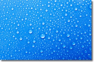
Weather Topic: What is Evaporation?
Home - Education - Precipitation - Evaporation
 Next Topic: Fog
Evaporation is the process which returns water from the earth
back to the atmosphere, and is another crucial process in the water cycle.
Evaporation is the transformation of liquid into gas, and it happens because
molecules are excited by the application of energy and turn into vapor.
In order for water to evaporate it has to be on the surface of a body of water.
Next Topic: Fog
Current conditions powered by WeatherAPI.com


