Weather Alert in Maine
Winter Weather Advisory issued February 9 at 12:50PM EST until February 11 at 4:00PM EST by NWS Gray ME
AREAS AFFECTED: Interior Waldo; Sagadahoc; Lincoln; Knox; Coastal Waldo
DESCRIPTION: * WHAT...Snow expected. Total snow accumulations between 4 and 6 inches. * WHERE...Coastal Waldo, Interior Waldo, Knox, Lincoln, and Sagadahoc Counties. * WHEN...From 7 PM Tuesday to 4 PM EST Wednesday. * IMPACTS...A weak weather system will bring a period of light snowfall to the region. Although snowfall amounts will be light, travel will still be impacted due to snowfall accumulations on untreated roads. The potential exists for snowbands that will bring periods of locally heavy snowfall, which will lead to rapid snow accumulations and dangerous travel conditions. The hazardous conditions could impact the Wednesday morning commute.
INSTRUCTION: Slow down and use caution while traveling. The latest road conditions can be obtained by going to newengland511.org
Want more detail? Get the Complete 7 Day and Night Detailed Forecast!
Current U.S. National Radar--Current
The Current National Weather Radar is shown below with a UTC Time (subtract 5 hours from UTC to get Eastern Time).

National Weather Forecast--Current
The Current National Weather Forecast and National Weather Map are shown below.

National Weather Forecast for Tomorrow
Tomorrow National Weather Forecast and Tomorrow National Weather Map are show below.

North America Water Vapor (Moisture)
This map shows recent moisture content over North America. Bright and colored areas show high moisture (ie, clouds); brown indicates very little moisture present; black indicates no moisture.

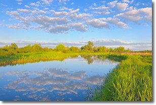
Weather Topic: What are Stratocumulus Clouds?
Home - Education - Cloud Types - Stratocumulus Clouds
 Next Topic: Stratus Clouds
Stratocumulus clouds are similar to altocumulus clouds in their
fluffy appearance, but have a slightly darker shade due to their additional mass.
A good way to distinguish the two cloud types is to hold your hand out and measure
the size of an individual cloud; if it is the size of your thumb it is generally
an altocumulus cloud, if it is the size of your hand it is generally a
stratocumulus cloud.
It is uncommon for stratocumulus clouds to produce precipitation, but if they do
it is usually a light rain or snow.
Next Topic: Stratus Clouds
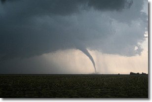
Weather Topic: What are Wall Clouds?
Home - Education - Cloud Types - Wall Clouds
 Next Topic: Altocumulus Clouds
A wall cloud forms underneath the base of a cumulonimbus cloud,
and can be a hotbed for deadly tornadoes.
Wall clouds are formed by air flowing into the cumulonimbus clouds, which can
result in the wall cloud descending from the base of the cumulonimbus cloud, or
rising fractus clouds which join to the base of the storm cloud as the wall cloud
takes shape.
Wall clouds can be very large, and in the Northern Hemisphere they generally
form at the southern edge of cumulonimbus clouds.
Next Topic: Altocumulus Clouds
Current conditions powered by WeatherAPI.com


