Weather Alert in Washington
Winter Storm Warning issued March 9 at 1:58PM PDT until March 13 at 5:00AM PDT by NWS Pendleton OR
AREAS AFFECTED: Upper Slopes of the Eastern Washington Cascades Crest
DESCRIPTION: * WHAT...Winter Weather Advisory, snow. Additional snow accumulations between 2 and 6 inches. Winds gusting as high as 30 mph rest of today. Winter Storm Warning, heavy snow expected. Total snow accumulations between 1 and 3 feet. Winds gusting as high as 35 mph 11 pm Wednesday to 5 pm Thursday. * WHERE...Upper Slopes of the Eastern Washington Cascades Crest. * WHEN...For the Winter Weather Advisory, until 8 AM PDT Tuesday. For the Winter Storm Warning, from 5 PM Tuesday to 5 AM PDT Friday. * IMPACTS...Heavy snowfall and very low visibility will create extremely dangerous driving conditions. Gusty winds could bring down tree branches. * ADDITIONAL DETAILS...A strong winter storm will bring heavy mountain snow Tuesday night through Friday morning. There is a lull expected which will occur late Wednesday morning through early Thursday morning as snow levels rise bringing a wintery mix or rain before decreasing Thursday returning heavy snow to pass-level.
INSTRUCTION: Persons should consider delaying all travel. If travel is absolutely necessary, drive with extreme caution. Consider taking a winter storm kit along with you, including such items as tire chains, booster cables, flashlight, shovel, blankets and extra clothing. Also take water, a first aid kit, and anything else that would help you survive in case you become stranded. Do not touch downed lines and report any power outages to your electric company. Travel is highly discouraged due to slick roadways and the possibility of downed trees and power lines. Slow down and use caution while traveling. The latest road conditions can be obtained by visiting the website wsdot.wa.gov/travel.
Want more detail? Get the Complete 7 Day and Night Detailed Forecast!
Current U.S. National Radar--Current
The Current National Weather Radar is shown below with a UTC Time (subtract 5 hours from UTC to get Eastern Time).

National Weather Forecast--Current
The Current National Weather Forecast and National Weather Map are shown below.

National Weather Forecast for Tomorrow
Tomorrow National Weather Forecast and Tomorrow National Weather Map are show below.

North America Water Vapor (Moisture)
This map shows recent moisture content over North America. Bright and colored areas show high moisture (ie, clouds); brown indicates very little moisture present; black indicates no moisture.

Weather Topic: What is Drizzle?
Home - Education - Precipitation - Drizzle
 Next Topic: Evaporation
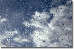
Drizzle is precipitation in the form of water droplets which are
smaller than raindrops.
Drizzle is characterized by fine, gently falling droplets and typically does not
impact human habitation in a negative way. The exception to this is freezing drizzle,
a condition where drizzle freezes immediately upon reaching earth's surface.
Freezing drizzle is still less dangerous than freezing rain, but can
potentially result in hazardous road conditions.
Next Topic: Evaporation
Weather Topic: What is Fog?
Home - Education - Cloud Types - Fog
 Next Topic: Fractus Clouds
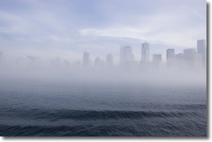
Fog is technically a type of stratus cloud, which lies along the
ground and obscures visibility.
It is usually created when humidity in the air condenses into tiny water droplets.
Because of this, some places are more prone to foggy weather, such as regions
close to a body of water.
Fog is similar to mist; both are the appearance of water droplets suspended in
the air, but fog is the term applied to the condition when visibility is less than 1 km.
Next Topic: Fractus Clouds
Current conditions powered by WeatherAPI.com


