Weather Alert in Indiana
Special Weather Statement issued March 1 at 3:27AM EST by NWS Louisville KY
AREAS AFFECTED: Orange; Washington; Scott; Jefferson; Dubois; Crawford; Perry; Harrison; Floyd; Clark; Hancock; Breckinridge; Meade; Hardin; Bullitt; Jefferson; Oldham; Henry; Shelby; Franklin; Scott; Harrison; Spencer; Anderson; Woodford; Fayette; Bourbon; Nicholas; Nelson; Washington; Mercer; Jessamine; Clark; Garrard; Madison
DESCRIPTION: Late tonight, a weather disturbance will move into the region from the west. Precipitation will likely start off as snow across much of southern Indiana, but a wintry mix of snow, sleet, and freezing rain will be possible, mainly in areas north of a line from Hawesville to Elizabethtown to Richmond. A slushy accumulation of up to one inch will be possible in areas along and north of the I-64 corridor. Just to the south of the I-64 corridor a light coating of snow with some very minor icing will be possible. While surface temperatures will be right at freezing, some slick travel will be possible during the Monday morning commute. Motorists should keep abreast of the latest forecasts and allow extra time to reach your destination Monday morning. Stay tuned to NOAA Weather Radio and your local media for the latest forecast updates.
INSTRUCTION: N/A
Want more detail? Get the Complete 7 Day and Night Detailed Forecast!
Current U.S. National Radar--Current
The Current National Weather Radar is shown below with a UTC Time (subtract 5 hours from UTC to get Eastern Time).

National Weather Forecast--Current
The Current National Weather Forecast and National Weather Map are shown below.

National Weather Forecast for Tomorrow
Tomorrow National Weather Forecast and Tomorrow National Weather Map are show below.

North America Water Vapor (Moisture)
This map shows recent moisture content over North America. Bright and colored areas show high moisture (ie, clouds); brown indicates very little moisture present; black indicates no moisture.

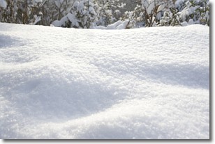
Weather Topic: What is Snow?
Home - Education - Precipitation - Snow
 Next Topic: Stratocumulus Clouds
Snow is precipitation taking the form of ice crystals. Each ice crystal, or snowflake,
has unique characteristics, but all of them grow in a hexagonal structure.
Snowfall can last for sustained periods of time and result in significant buildup
of snow on the ground.
On the earth's surface, snow starts out light and powdery, but as it begins to melt
it tends to become more granular, producing small bits of ice which have the consistency of
sand. After several cycles of melting and freezing, snow can become very dense
and ice-like, commonly known as snow pack.
Next Topic: Stratocumulus Clouds
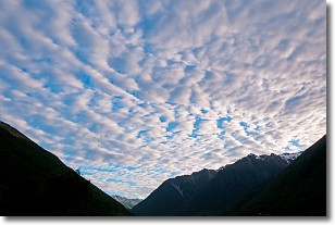
Weather Topic: What are Stratus Clouds?
Home - Education - Cloud Types - Stratus Clouds
 Next Topic: Wall Clouds
Stratus clouds are similar to altostratus clouds, but form at a
lower altitude and are identified by their fog-like appearance, lacking the
distinguishing features of most clouds.
Stratus clouds are wider than most clouds, and their base has a smooth, uniform
look which is lighter in color than a nimbostratus cloud.
The presence of a stratus cloud indicates the possibility of minor precipitation,
such as drizzle, but heavier precipitation does not typically arrive in the form
of a stratus cloud.
Next Topic: Wall Clouds
Current conditions powered by WeatherAPI.com


