Weather Alert in Indiana
Severe Thunderstorm Watch issued March 31 at 10:28AM EDT until March 31 at 6:00PM EDT by NWS Northern Indiana
AREAS AFFECTED: Adams, IN; Allen, IN; Blackford, IN; Cass, IN; De Kalb, IN; Elkhart, IN; Fulton, IN; Grant, IN; Huntington, IN; Jay, IN; Kosciusko, IN; Lagrange, IN; La Porte, IN; Marshall, IN; Miami, IN; Noble, IN; Pulaski, IN; St. Joseph, IN; Starke, IN; Steuben, IN; Wabash, IN; Wells, IN; White, IN; Whitley, IN; Berrien, MI; Branch, MI; Cass, MI; Hillsdale, MI; St. Joseph, MI; Allen, OH; Defiance, OH; Fulton, OH; Henry, OH; Paulding, OH; Putnam, OH; Van Wert, OH; Williams, OH
DESCRIPTION: THE NATIONAL WEATHER SERVICE HAS ISSUED SEVERE THUNDERSTORM WATCH 78 IN EFFECT UNTIL 6 PM EDT /5 PM CDT/ THIS EVENING FOR THE FOLLOWING AREAS IN INDIANA THIS WATCH INCLUDES 24 COUNTIES IN NORTH CENTRAL INDIANA KOSCIUSKO ST. JOSEPH IN NORTHERN INDIANA ADAMS ALLEN IN BLACKFORD CASS IN DE KALB ELKHART FULTON IN GRANT HUNTINGTON JAY LA PORTE LAGRANGE MARSHALL MIAMI NOBLE PULASKI STARKE STEUBEN WABASH WELLS WHITE WHITLEY IN MICHIGAN THIS WATCH INCLUDES 5 COUNTIES IN SOUTHWEST MICHIGAN BERRIEN BRANCH CASS MI HILLSDALE ST. JOSEPH MI IN OHIO THIS WATCH INCLUDES 8 COUNTIES IN NORTHWEST OHIO ALLEN OH DEFIANCE FULTON OH HENRY PAULDING PUTNAM VAN WERT WILLIAMS THIS INCLUDES THE CITIES OF AKRON, ALBION, ANGOLA, ANTWERP, ARCHBOLD, AUBURN, BASS LAKE, BENTON HARBOR, BENTON HEIGHTS, BERNE, BLUFFTON, BLUFFTON, BREMEN, BRONSON, BROOKSTON, BRYAN, BUCHANAN, CASSOPOLIS, COLDWATER, COLUMBIA CITY, COLUMBUS GROVE, CONTINENTAL, CULVER, DECATUR, DEFIANCE, DELTA, DESHLER, DOWAGIAC, DUNKIRK, EDGERTON, EDWARDSBURG, ELKHART, FAIR PLAIN, FORT WAYNE, FRANCESVILLE, FREMONT, GARRETT, GAS CITY, GOSHEN, GRANGER, GRISSOM AFD, HARTFORD CITY, HICKSVILLE, HILLSDALE, HUNTINGTON, JONESVILLE, KENDALLVILLE, KNOX, LA PORTE, LAGRANGE, LEIPSIC, LIBERTY CENTER, LIGONIER, LIMA, LITCHFIELD, LOGANSPORT, MARCELLUS, MARION, MEDARYVILLE, MENDON, MEXICO, MICHIGAN CITY, MISHAWAKA, MONON, MONTICELLO, MONTPELIER, MONTPELIER, NAPOLEON, NAPPANEE, NEW HAVEN, NILES, NORTH JUDSON, NORTH MANCHESTER, OHIO CITY, OSSIAN, OTTAWA, PANDORA, PAULDING, PAW PAW LAKE, PAYNE, PERU, PLYMOUTH, PORTLAND, ROANOKE, ROCHESTER, ROYAL CENTER, SHERWOOD, SHIPSHEWANA, SOUTH BEND, SOUTH WHITLEY, SPENCERVILLE, ST. JOSEPH, STURGIS, SWANTON, THREE RIVERS, TOPEKA, TRI-LAKES, UPLAND, VAN WERT, WABASH, WARSAW, WAUSEON, WHITE PIGEON, WINAMAC, AND WINONA LAKE.
INSTRUCTION: N/A
Want more detail? Get the Complete 7 Day and Night Detailed Forecast!
Current U.S. National Radar--Current
The Current National Weather Radar is shown below with a UTC Time (subtract 5 hours from UTC to get Eastern Time).

National Weather Forecast--Current
The Current National Weather Forecast and National Weather Map are shown below.

National Weather Forecast for Tomorrow
Tomorrow National Weather Forecast and Tomorrow National Weather Map are show below.

North America Water Vapor (Moisture)
This map shows recent moisture content over North America. Bright and colored areas show high moisture (ie, clouds); brown indicates very little moisture present; black indicates no moisture.

Weather Topic: What are Cumulonimbus Clouds?
Home - Education - Cloud Types - Cumulonimbus Clouds
 Next Topic: Cumulus Clouds
The final form taken by a growing cumulus cloud is the
cumulonimbus cloud, which is very tall and dense.
The tower of a cumulonimbus cloud can soar 23 km into the atmosphere, although
most commonly they stop growing at an altitude of 6 km.
Even small cumulonimbus clouds appear very large in comparison to other cloud types.
They can signal the approach of stormy weather, such as thunderstorms or blizzards.
Next Topic: Cumulus Clouds
Weather Topic: What is Drizzle?
Home - Education - Precipitation - Drizzle
 Next Topic: Evaporation
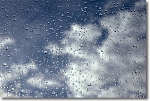
Drizzle is precipitation in the form of water droplets which are
smaller than raindrops.
Drizzle is characterized by fine, gently falling droplets and typically does not
impact human habitation in a negative way. The exception to this is freezing drizzle,
a condition where drizzle freezes immediately upon reaching earth's surface.
Freezing drizzle is still less dangerous than freezing rain, but can
potentially result in hazardous road conditions.
Next Topic: Evaporation
Current conditions powered by WeatherAPI.com


