Weather Alert in Alaska
Special Weather Statement issued February 8 at 1:57PM AKST by NWS Juneau AK
AREAS AFFECTED: City and Borough of Yakutat; Municipality of Skagway; Haines Borough and Klukwan; Glacier Bay; Eastern Chichagof Island; Cape Fairweather to Lisianski Strait; City and Borough of Sitka; Admiralty Island; City and Borough of Juneau; Petersburg Borough; Western Kupreanof and Kuiu Island; Prince of Wales Island; City and Borough of Wrangell; Ketchikan Gateway Borough; City of Hyder; Annette Island
DESCRIPTION: After a series of shortwaves that brought rain and gusty winds over the past few days, a stronger front will approach southeast Alaska from the west on Tuesday. South to southeast winds will increase through the day Tuesday. Confidence is increasing for windy conditions with strong gusts Tuesday night into Wednesday morning as the front pushes west to east across southeast Alaska. Gales with storm force gusts will be possible ahead and along the frontal passage, especially along north-south oriented channels and along the coastal waters. A period of moderate to heavy rainfall will be possible with the frontal passage, but with the progressive nature of the front, flooding is not expected at this time. Another gale to potentially storm force low will quickly lift northeast into the Gulf and looks to push across southeast Alaska sometime later Wednesday into Thursday, bringing another round of strong gusty winds and moderate to heavy rainfall. Further details on the high wind and flooding potential for this system will be honed in on in the coming days. Looking further ahead, a cooling trend is favored to commence in the wake of these passing systems by late work week into the weekend. Snow levels will begin to lower and a colder outflow wind pattern could set up by late weekend. This could result in a return of snow for some coastal communities, especially across northern southeast Alaska. Further details on the pattern change and snow potential will be honed as the weekend approaches.
INSTRUCTION: N/A
Want more detail? Get the Complete 7 Day and Night Detailed Forecast!
Current U.S. National Radar--Current
The Current National Weather Radar is shown below with a UTC Time (subtract 5 hours from UTC to get Eastern Time).

National Weather Forecast--Current
The Current National Weather Forecast and National Weather Map are shown below.

National Weather Forecast for Tomorrow
Tomorrow National Weather Forecast and Tomorrow National Weather Map are show below.

North America Water Vapor (Moisture)
This map shows recent moisture content over North America. Bright and colored areas show high moisture (ie, clouds); brown indicates very little moisture present; black indicates no moisture.

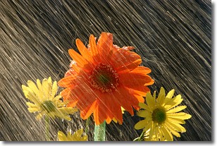
Weather Topic: What is Rain?
Home - Education - Precipitation - Rain
 Next Topic: Shelf Clouds
Precipitation in the form of water droplets is called rain.
Rain generally has a tendency to fall with less intensity over a greater period
of time, and when rainfall is more severe it is usually less sustained.
Rain is the most common form of precipitation and happens with greater frequency
depending on the season and regional influences. Cities have been shown to have
an observable effect on rainfall, due to an effect called the urban heat island.
Compared to upwind, monthly rainfall between twenty and forty miles downwind of
cities is 30% greater.
Next Topic: Shelf Clouds
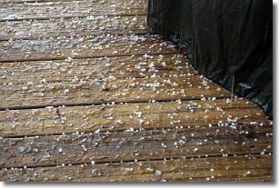
Weather Topic: What is Sleet?
Home - Education - Precipitation - Sleet
 Next Topic: Snow
Sleet is a form of precipitation in which small ice pellets are the primary
components. These ice pellets are smaller and more translucent than hailstones,
and harder than graupel. Sleet is caused by specific atmospheric conditions and
therefore typically doesn't last for extended periods of time.
The condition which leads to sleet formation requires a warmer body of air to be
wedged in between two sub-freezing bodies of air. When snow falls through a warmer
layer of air it melts, and as it falls through the next sub-freezing body of air
it freezes again, forming ice pellets known as sleet. In some cases, water
droplets don't have time to freeze before reaching the surface and the result is
freezing rain.
Next Topic: Snow
Current conditions powered by WeatherAPI.com


