Weather Alert in Alaska
Winter Weather Advisory issued February 8 at 3:24PM AKST until February 9 at 6:00PM AKST by NWS Anchorage AK
AREAS AFFECTED: Central Copper Valley; Southern Copper Valley; Tok Cutoff; McCarthy
DESCRIPTION: * WHAT...Snow. Additional snow accumulations between 4 and 12 inches. Highest amounts near McCarthy and along the Tok Cutoff from Chistochina to Mentasta Pass. Winds gusting as high as 30 mph along the Tok Cutoff. * WHERE...Central Copper Valley, McCarthy, Southern Copper Valley, and Tok Cutoff. * WHEN...Until 6 PM AKST Monday. * IMPACTS...Travel could be very difficult, especially along the Edgerton Highway and along the Tok Cutoff. The combination of heavy snowfall, gusty winds, and easily transportable snow could result in significantly reduced visibilities on area roadways, especially through Mentasta Pass and along the Tok Cutoff. * ADDITIONAL DETAILS...A long duration snow will continue across the Copper Valley, along the Tok Cutoff to Mentasta Pass, and along the Edgerton Highway to McCarthy. Light snow will continue through tonight before intensity increases early Monday morning. Snowfall rates of one to two inches per hour are possible at times Monday morning and afternoon. Snow will begin to taper off Monday evening.
INSTRUCTION: Slow down and use caution while traveling. For the latest road conditions call 5 1 1 or visit 511.alaska.gov.
Want more detail? Get the Complete 7 Day and Night Detailed Forecast!
Current U.S. National Radar--Current
The Current National Weather Radar is shown below with a UTC Time (subtract 5 hours from UTC to get Eastern Time).

National Weather Forecast--Current
The Current National Weather Forecast and National Weather Map are shown below.

National Weather Forecast for Tomorrow
Tomorrow National Weather Forecast and Tomorrow National Weather Map are show below.

North America Water Vapor (Moisture)
This map shows recent moisture content over North America. Bright and colored areas show high moisture (ie, clouds); brown indicates very little moisture present; black indicates no moisture.

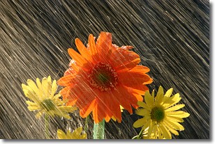
Weather Topic: What is Rain?
Home - Education - Precipitation - Rain
 Next Topic: Shelf Clouds
Precipitation in the form of water droplets is called rain.
Rain generally has a tendency to fall with less intensity over a greater period
of time, and when rainfall is more severe it is usually less sustained.
Rain is the most common form of precipitation and happens with greater frequency
depending on the season and regional influences. Cities have been shown to have
an observable effect on rainfall, due to an effect called the urban heat island.
Compared to upwind, monthly rainfall between twenty and forty miles downwind of
cities is 30% greater.
Next Topic: Shelf Clouds
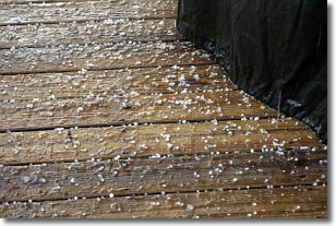
Weather Topic: What is Sleet?
Home - Education - Precipitation - Sleet
 Next Topic: Snow
Sleet is a form of precipitation in which small ice pellets are the primary
components. These ice pellets are smaller and more translucent than hailstones,
and harder than graupel. Sleet is caused by specific atmospheric conditions and
therefore typically doesn't last for extended periods of time.
The condition which leads to sleet formation requires a warmer body of air to be
wedged in between two sub-freezing bodies of air. When snow falls through a warmer
layer of air it melts, and as it falls through the next sub-freezing body of air
it freezes again, forming ice pellets known as sleet. In some cases, water
droplets don't have time to freeze before reaching the surface and the result is
freezing rain.
Next Topic: Snow
Current conditions powered by WeatherAPI.com


