Weather Alert in California
High Surf Advisory High Wind Watch Wind Advisory Winter Storm Watch
Flood Watch issued February 14 at 12:20PM PST until February 16 at 9:00PM PST by NWS Los Angeles/Oxnard CA
AREAS AFFECTED: Catalina and Santa Barbara Islands; Santa Clarita Valley; Santa Ynez Valley; Santa Barbara County Southwestern Coast; Santa Barbara County Southeastern Coast; Santa Ynez Mountains Western Range; Santa Ynez Mountains Eastern Range; Santa Barbara County Interior Mountains; Ventura County Beaches; Ventura County Inland Coast; Lake Casitas; Ojai Valley; Central Ventura County Valleys; Malibu Coast; Los Angeles County Beaches; Palos Verdes Hills; Los Angeles County Inland Coast including Downtown Los Angeles; Western Santa Monica Mountains Recreational Area; Eastern Santa Monica Mountains Recreational Area; Calabasas and Agoura Hills; Western San Fernando Valley; Eastern San Fernando Valley; Southeastern Ventura County Valleys; Santa Susana Mountains; Southern Ventura County Mountains; Northern Ventura County Mountains; Interstate 5 Corridor; Western San Gabriel Mountains and Highway 14 Corridor; Eastern San Gabriel Mountains; Los Angeles County San Gabriel Valley; San Miguel and Santa Rosa Islands; Santa Cruz and Anacapa Islands
DESCRIPTION: * WHAT...Flooding caused by excessive rainfall is possible. Rock and mud slides are possible near steep terrain. Debris flows are possible on burn scars. * WHERE...A portion of southwest California, including the following areas, most of Central and Southern Los Angeles County, all of Ventura County, and most of Central and Southern Ventura County, including several burn scar areas. * WHEN...From Monday morning through Monday evening. * IMPACTS...Flash flooding is possible. Excessive runoff may result in flooding of low-lying and flood-prone locations, including creeks and streams. Flooding may occur in poor drainage and urban areas. Low-water crossings may be flooded. Extensive street flooding is possible. * ADDITIONAL DETAILS... - A line of heavy showers and thunderstorms will sweep across the region on Monday, bringing the risk for flash flooding, rock and mud slides, and burn-scar debris flows across the Flood Watch area. After the passage of the line, scattered heavy showers and thunderstorms will continue into Monday evening, prolonging the flooding risk in isolated locations. Flooding and burn-scar debris flows are not expected for areas above the snow level, of approximately 6000 feet to 6500 feet elevation, where snow will fall instead of rain. - http://www.weather.gov/safety/flood
INSTRUCTION: You should monitor later forecasts and be alert for possible Flood Warnings. Those living in areas prone to flooding should be prepared to take action should flooding develop. Travel through passes and canyons could become dangerous, and be alert for rock slides and mud slides. Follow the direction of Emergency Management and Law Enforcement officials.
Want more detail? Get the Complete 7 Day and Night Detailed Forecast!
Current U.S. National Radar--Current
The Current National Weather Radar is shown below with a UTC Time (subtract 5 hours from UTC to get Eastern Time).

National Weather Forecast--Current
The Current National Weather Forecast and National Weather Map are shown below.

National Weather Forecast for Tomorrow
Tomorrow National Weather Forecast and Tomorrow National Weather Map are show below.

North America Water Vapor (Moisture)
This map shows recent moisture content over North America. Bright and colored areas show high moisture (ie, clouds); brown indicates very little moisture present; black indicates no moisture.

Weather Topic: What is Evaporation?
Home - Education - Precipitation - Evaporation
 Next Topic: Fog
Evaporation is the process which returns water from the earth
back to the atmosphere, and is another crucial process in the water cycle.
Evaporation is the transformation of liquid into gas, and it happens because
molecules are excited by the application of energy and turn into vapor.
In order for water to evaporate it has to be on the surface of a body of water.
Next Topic: Fog
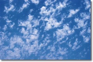
Weather Topic: What are Fractus Clouds?
Home - Education - Cloud Types - Fractus Clouds
 Next Topic: Freezing Rain
A fractus cloud (scud) is a fragmented, tattered cloud which has
likely been sheared off of another cloud. They are accessory clouds, meaning they
develop from parent clouds, and are named in a way which describes the original
cloud which contained them.
Fractus clouds which have originated from cumulus clouds are referred to as
cumulus fractus, while fractus clouds which have originated from stratus clouds
are referred to as stratus fractus. Under certain conditions a fractus cloud might
merge with another cloud, or develop into a cumulus cloud, but usually a
fractus cloud seen by itself will dissipate rapidly.
They are often observed on the leading and trailing edges of storm clouds,
and are a display of wind activity.
Next Topic: Freezing Rain
Current conditions powered by WeatherAPI.com


