Weather Alert in New Mexico
Hydrologic Outlook issued August 27 at 10:52AM MDT by NWS Albuquerque NM
AREAS AFFECTED: Colfax, NM; Mora, NM; San Miguel, NM; Taos, NM
DESCRIPTION: ESFABQ Heightened Risk of River and Stream Flooding During Storm Events Through the Holiday Weekend. Repeated rounds of heavy rainfall in the area over the last several days have saturated the soils and raised the baseflow of rivers and streams in the area. We have reports of streams near the Mora, Sapello, Pecos and Vermejo river rising out of their banks, with additional reports of flowing water and debris across roads such as 518. These waterways will be extremely vulnerable to further rounds of precipitation, which we are expecting over the next week as a surge of deep monsoon moisture moves through the area. Expect further rises and impacts to nearby roads and low water crossings. Stay aware of any flash flood or river flood warnings that are issued. Exercise caution along riverbanks and watch out for potential mudslides across roads. For questions or comments about this outlook, you can contact Andrew Mangham, Senior Service Hydrologist, at 505-244-9150 x 228 or via e- mail at andrew.mangham@noaa.gov.
INSTRUCTION: N/A
Want more detail? Get the Complete 7 Day and Night Detailed Forecast!
Current U.S. National Radar--Current
The Current National Weather Radar is shown below with a UTC Time (subtract 5 hours from UTC to get Eastern Time).

National Weather Forecast--Current
The Current National Weather Forecast and National Weather Map are shown below.

National Weather Forecast for Tomorrow
Tomorrow National Weather Forecast and Tomorrow National Weather Map are show below.

North America Water Vapor (Moisture)
This map shows recent moisture content over North America. Bright and colored areas show high moisture (ie, clouds); brown indicates very little moisture present; black indicates no moisture.

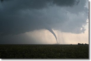
Weather Topic: What are Wall Clouds?
Home - Education - Cloud Types - Wall Clouds
 Next Topic: Altocumulus Clouds
A wall cloud forms underneath the base of a cumulonimbus cloud,
and can be a hotbed for deadly tornadoes.
Wall clouds are formed by air flowing into the cumulonimbus clouds, which can
result in the wall cloud descending from the base of the cumulonimbus cloud, or
rising fractus clouds which join to the base of the storm cloud as the wall cloud
takes shape.
Wall clouds can be very large, and in the Northern Hemisphere they generally
form at the southern edge of cumulonimbus clouds.
Next Topic: Altocumulus Clouds
Weather Topic: What are Altostratus Clouds?
Home - Education - Cloud Types - Altostratus Clouds
 Next Topic: Cirrocumulus Clouds
Altostratus clouds form at mid to high-level altitudes
(between 2 and 7 km) and are created by a warm, stable air mass which causes
water vapor
to condense as it rise through the atmosphere. Usually altostratus clouds are
featureless sheets characterized by a uniform color.
In some cases, wind punching through the cloud formation may give it a waved
appearance, called altostratus undulatus. Altostratus clouds
are commonly seen with other cloud formations accompanying them.
Next Topic: Cirrocumulus Clouds
Current conditions powered by WeatherAPI.com


