Weather Alert in California
Winter Storm Watch issued February 13 at 12:41PM PST until February 18 at 4:00AM PST by NWS Medford OR
AREAS AFFECTED: Western Siskiyou County
DESCRIPTION: * WHAT...Heavy snow possible above 3000 ft. Total snow accumulations of 6 to 12 inches, with 1 to 2 feet above 5000 ft possible. Winds could gust as high as 40 mph over high and exposed terrain. * WHERE...Elevations above 3000 ft in western Siskiyou County. This includes Etna Summit on Sawyers Bar Rd and Highway 3 south of Callahan. * WHEN...From Sunday evening through late Tuesday night. * IMPACTS...Travel may be very difficult to impossible. The hazardous conditions could impact the Monday morning and evening commutes. * ADDITIONAL DETAILS...Snow levels are expected to lower to 4500 ft Sunday night then down to 4000 ft Monday. Snow levels lower further Monday night into Tuesday, possibly as low as 2000 ft by Tuesday morning. This could result in light snow accumulations of 1 to 3 inches in the Scott and Klamath River Valleys.
INSTRUCTION: Monitor the latest forecasts for updates on this situation. People should consider delaying travel. If travel is absolutely necessary, drive with extreme caution. Take a winter storm kit with you that includes tire chains, booster cables, flashlight, shovel, blankets and extra clothing. Also take water, a first aid kit, and anything else that would help you survive in case you become stranded.
Want more detail? Get the Complete 7 Day and Night Detailed Forecast!
Current U.S. National Radar--Current
The Current National Weather Radar is shown below with a UTC Time (subtract 5 hours from UTC to get Eastern Time).

National Weather Forecast--Current
The Current National Weather Forecast and National Weather Map are shown below.

National Weather Forecast for Tomorrow
Tomorrow National Weather Forecast and Tomorrow National Weather Map are show below.

North America Water Vapor (Moisture)
This map shows recent moisture content over North America. Bright and colored areas show high moisture (ie, clouds); brown indicates very little moisture present; black indicates no moisture.

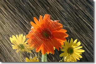
Weather Topic: What is Precipitation?
Home - Education - Precipitation - Precipitation
 Next Topic: Rain
Precipitation can refer to many different forms of water that
may fall from clouds. Precipitation occurs after a cloud has become saturated to
the point where its water particles are more dense than the air below the cloud.
In most cases, precipitation will reach the ground, but it is not uncommon for
precipitation to evaporate before it reaches the earth's surface.
When precipitation evaporates before it contacts the ground it is called Virga.
Graupel, hail, sleet, rain, drizzle, and snow are forms of precipitation, but fog
and mist are not considered precipitation because the water vapor which
constitutes them isn't dense enough to fall to the ground.
Next Topic: Rain
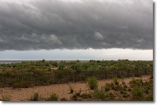
Weather Topic: What are Shelf Clouds?
Home - Education - Cloud Types - Shelf Clouds
 Next Topic: Sleet
A shelf cloud is similar to a wall cloud, but forms at the front
of a storm cloud, instead of at the rear, where wall clouds form.
A shelf cloud is caused by a series of events set into motion by the advancing
storm; first, cool air settles along the ground where precipitation has just fallen.
As the cool air is brought in, the warmer air is displaced, and rises above it,
because it is less dense. When the warmer air reaches the bottom of the storm cloud,
it begins to cool again, and the resulting condensation is a visible shelf cloud.
Next Topic: Sleet
Current conditions powered by WeatherAPI.com


