Weather Alert in California
Winter Storm Watch issued February 13 at 12:41PM PST until February 18 at 4:00AM PST by NWS Medford OR
AREAS AFFECTED: Western Siskiyou County
DESCRIPTION: * WHAT...Heavy snow possible above 3000 ft. Total snow accumulations of 6 to 12 inches, with 1 to 2 feet above 5000 ft possible. Winds could gust as high as 40 mph over high and exposed terrain. * WHERE...Elevations above 3000 ft in western Siskiyou County. This includes Etna Summit on Sawyers Bar Rd and Highway 3 south of Callahan. * WHEN...From Sunday evening through late Tuesday night. * IMPACTS...Travel may be very difficult to impossible. The hazardous conditions could impact the Monday morning and evening commutes. * ADDITIONAL DETAILS...Snow levels are expected to lower to 4500 ft Sunday night then down to 4000 ft Monday. Snow levels lower further Monday night into Tuesday, possibly as low as 2000 ft by Tuesday morning. This could result in light snow accumulations of 1 to 3 inches in the Scott and Klamath River Valleys.
INSTRUCTION: Monitor the latest forecasts for updates on this situation. People should consider delaying travel. If travel is absolutely necessary, drive with extreme caution. Take a winter storm kit with you that includes tire chains, booster cables, flashlight, shovel, blankets and extra clothing. Also take water, a first aid kit, and anything else that would help you survive in case you become stranded.
Want more detail? Get the Complete 7 Day and Night Detailed Forecast!
Current U.S. National Radar--Current
The Current National Weather Radar is shown below with a UTC Time (subtract 5 hours from UTC to get Eastern Time).

National Weather Forecast--Current
The Current National Weather Forecast and National Weather Map are shown below.

National Weather Forecast for Tomorrow
Tomorrow National Weather Forecast and Tomorrow National Weather Map are show below.

North America Water Vapor (Moisture)
This map shows recent moisture content over North America. Bright and colored areas show high moisture (ie, clouds); brown indicates very little moisture present; black indicates no moisture.

Weather Topic: What is Condensation?
Home - Education - Precipitation - Condensation
 Next Topic: Contrails
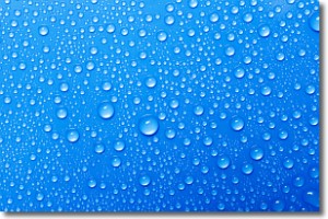
Condensation is the process which creates clouds, and therefore
it is a crucial process in the water cycle.
Condensation is the change of matter from a state of gas into a state of liquid,
and it happens because water molecules release heat into the atmosphere and
become organized into a more closely packed structure, what we might see as
water droplets.
Water is always present in the air around us as a vapor, but it's too small for
us to see. When water undergoes the process of condensation it becomes organized
into visible water droplets. You've probably seen condensation happen before on the
surface of a cold drink!
Next Topic: Contrails
Weather Topic: What are Cumulonimbus Clouds?
Home - Education - Cloud Types - Cumulonimbus Clouds
 Next Topic: Cumulus Clouds
The final form taken by a growing cumulus cloud is the
cumulonimbus cloud, which is very tall and dense.
The tower of a cumulonimbus cloud can soar 23 km into the atmosphere, although
most commonly they stop growing at an altitude of 6 km.
Even small cumulonimbus clouds appear very large in comparison to other cloud types.
They can signal the approach of stormy weather, such as thunderstorms or blizzards.
Next Topic: Cumulus Clouds
Current conditions powered by WeatherAPI.com


