Weather Alert in Washington
Blizzard Warning issued March 9 at 1:42PM PDT until March 11 at 11:00PM PDT by NWS Seattle WA
AREAS AFFECTED: Cascades of Whatcom and Skagit Counties; Cascades of Snohomish and Northern King Counties
DESCRIPTION: * WHAT...For the Winter Storm Warning, heavy snow. Additional snow accumulations between 6 and 11 inches. For the Winter Weather Advisory, snow expected. Total snow accumulations between 2 and 4 inches. For the Blizzard Warning, blizzard conditions expected primarily Wednesday afternoon and evening. Winds gusting as high as 40 mph. Total snow accumulations between 2 and 4 feet possible. For the Winter Storm Watch, continued heavy snow is possible. * WHERE...Cascades of Snohomish and Northern King Counties and Cascades of Whatcom and Skagit Counties. * WHEN...For the Winter Storm Warning, until 5 AM PDT Tuesday. For the Winter Weather Advisory, from 5 AM to 5 PM PDT Tuesday. For the Blizzard Warning, from 5 PM Tuesday to 11 PM PDT Wednesday. The strongest winds will peak Wednesday evening into late Wednesday night. For the Winter Storm Watch, from Wednesday evening through Friday morning. * IMPACTS...Visibilities may drop below 1/4 mile due to falling and blowing snow. Travel could be very difficult to impossible. Gusty winds could bring down tree branches. * ADDITIONAL DETAILS...The strongest winds will occur over the passes on Wednesday evening into late Wednesday night.
INSTRUCTION: Travel should be restricted to emergencies only. If you must travel, have a winter survival kit with you. If you get stranded, stay with your vehicle. Prepare for possible power outages. Slow down and use caution while traveling. Prepare for possible power outages. Monitor the latest forecasts for updates on this situation. If you must travel, keep an extra flashlight, food, and water in your vehicle in case of an emergency. Prepare for possible power outages.
Want more detail? Get the Complete 7 Day and Night Detailed Forecast!
Current U.S. National Radar--Current
The Current National Weather Radar is shown below with a UTC Time (subtract 5 hours from UTC to get Eastern Time).

National Weather Forecast--Current
The Current National Weather Forecast and National Weather Map are shown below.

National Weather Forecast for Tomorrow
Tomorrow National Weather Forecast and Tomorrow National Weather Map are show below.

North America Water Vapor (Moisture)
This map shows recent moisture content over North America. Bright and colored areas show high moisture (ie, clouds); brown indicates very little moisture present; black indicates no moisture.

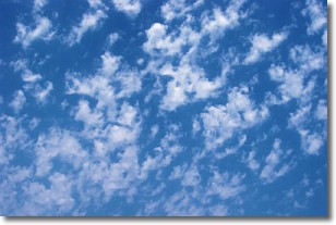
Weather Topic: What are Fractus Clouds?
Home - Education - Cloud Types - Fractus Clouds
 Next Topic: Freezing Rain
A fractus cloud (scud) is a fragmented, tattered cloud which has
likely been sheared off of another cloud. They are accessory clouds, meaning they
develop from parent clouds, and are named in a way which describes the original
cloud which contained them.
Fractus clouds which have originated from cumulus clouds are referred to as
cumulus fractus, while fractus clouds which have originated from stratus clouds
are referred to as stratus fractus. Under certain conditions a fractus cloud might
merge with another cloud, or develop into a cumulus cloud, but usually a
fractus cloud seen by itself will dissipate rapidly.
They are often observed on the leading and trailing edges of storm clouds,
and are a display of wind activity.
Next Topic: Freezing Rain
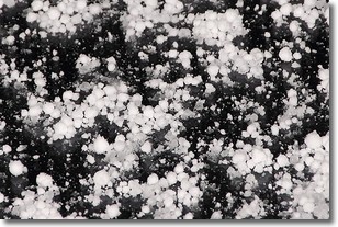
Weather Topic: What is Graupel?
Home - Education - Precipitation - Graupel
 Next Topic: Hail
Graupel is a form of precipitation that is created by atmospheric conditions
which cause supercooled water droplets to contact snow crystals and freeze to
their surface.
Sometimes known as soft hail or snow pellets, graupel is delicate and easily
destroyed by touch. Whereas hail usually falls during severe weather, graupel
doesn't require such conditions to form, and can form in mild precipitation
similar to situations which produce snowfall.
Next Topic: Hail
Current conditions powered by WeatherAPI.com


