Weather Alert in Iowa
Special Weather Statement issued September 2 at 1:06PM CDT by NWS La Crosse WI
AREAS AFFECTED: Mitchell; Howard; Winneshiek; Floyd; Chickasaw; Winona; Fillmore; Houston; Buffalo; Trempealeau; La Crosse
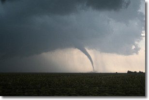
DESCRIPTION: Funnel clouds may develop this afternoon across portions of northeast Iowa, southeast Minnesota, and west central Wisconsin. These funnel clouds normally do not touch the ground. As a result, they rarely do any damage and last only a few minutes. However, if you live in these areas...remain on the alert and be prepared to move to a place of safety if a funnel should approach the ground. Atmospheric conditions along a corridor roughly from Charles City IA to Galesville WI, including the cities of Decorah IA, Winona MN, Preston MN, and La Crosse WI and other nearby locations will continue to be favorable for the formation of short lived funnels during the next several hours.
INSTRUCTION: N/A
Want more detail? Get the Complete 7 Day and Night Detailed Forecast!
Current U.S. National Radar--Current
The Current National Weather Radar is shown below with a UTC Time (subtract 5 hours from UTC to get Eastern Time).

National Weather Forecast--Current
The Current National Weather Forecast and National Weather Map are shown below.

National Weather Forecast for Tomorrow
Tomorrow National Weather Forecast and Tomorrow National Weather Map are show below.

North America Water Vapor (Moisture)
This map shows recent moisture content over North America. Bright and colored areas show high moisture (ie, clouds); brown indicates very little moisture present; black indicates no moisture.

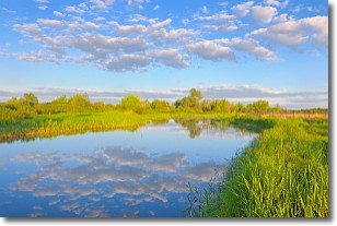
Weather Topic: What are Stratocumulus Clouds?
Home - Education - Cloud Types - Stratocumulus Clouds
 Next Topic: Stratus Clouds
Stratocumulus clouds are similar to altocumulus clouds in their
fluffy appearance, but have a slightly darker shade due to their additional mass.
A good way to distinguish the two cloud types is to hold your hand out and measure
the size of an individual cloud; if it is the size of your thumb it is generally
an altocumulus cloud, if it is the size of your hand it is generally a
stratocumulus cloud.
It is uncommon for stratocumulus clouds to produce precipitation, but if they do
it is usually a light rain or snow.
Next Topic: Stratus Clouds
Weather Topic: What are Wall Clouds?
Home - Education - Cloud Types - Wall Clouds
 Next Topic: Altocumulus Clouds
A wall cloud forms underneath the base of a cumulonimbus cloud,
and can be a hotbed for deadly tornadoes.
Wall clouds are formed by air flowing into the cumulonimbus clouds, which can
result in the wall cloud descending from the base of the cumulonimbus cloud, or
rising fractus clouds which join to the base of the storm cloud as the wall cloud
takes shape.
Wall clouds can be very large, and in the Northern Hemisphere they generally
form at the southern edge of cumulonimbus clouds.
Next Topic: Altocumulus Clouds
Current conditions powered by WeatherAPI.com


