Weather Alert in Kansas
Flood Warning issued August 27 at 2:04PM CDT until September 1 at 3:12AM CDT by NWS Wichita KS
AREAS AFFECTED: Butler, KS; Cowley, KS
DESCRIPTION: ...The National Weather Service in Wichita KS has issued a Flood Warning for the following rivers in Kansas... Walnut River at Augusta affecting Cowley and Butler Counties. Walnut River at Winfield affecting Cowley and Butler Counties. * WHAT...Moderate flooding is forecast. * WHERE...Walnut River at Winfield. * WHEN...From Friday evening to early Monday morning. * IMPACTS...At 22.0 feet, A large portion of the fairgrounds flood along with rural roads about 3 miles northwest of Winfield that are near the river. Then one mile west of the city of Rock, expect 30th Road to be closed due to high water. * ADDITIONAL DETAILS... - At 1:00 PM CDT Wednesday the stage was 2.2 feet. - Forecast...The river is expected to rise above flood stage Friday evening to a crest of 23.5 feet early Sunday morning. It will then fall below flood stage Sunday afternoon. - Flood stage is 18.0 feet.
INSTRUCTION: Do not drive into flooded areas or go around barricades. Nearly two feet of water will carry most vehicles away. Turn around, don't drown. Additional information is available at www.weather.gov. The next statement will be issued late tonight at 215 AM CDT.
Want more detail? Get the Complete 7 Day and Night Detailed Forecast!
Current U.S. National Radar--Current
The Current National Weather Radar is shown below with a UTC Time (subtract 5 hours from UTC to get Eastern Time).

National Weather Forecast--Current
The Current National Weather Forecast and National Weather Map are shown below.

National Weather Forecast for Tomorrow
Tomorrow National Weather Forecast and Tomorrow National Weather Map are show below.

North America Water Vapor (Moisture)
This map shows recent moisture content over North America. Bright and colored areas show high moisture (ie, clouds); brown indicates very little moisture present; black indicates no moisture.

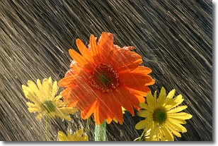
Weather Topic: What is Precipitation?
Home - Education - Precipitation - Precipitation
 Next Topic: Rain
Precipitation can refer to many different forms of water that
may fall from clouds. Precipitation occurs after a cloud has become saturated to
the point where its water particles are more dense than the air below the cloud.
In most cases, precipitation will reach the ground, but it is not uncommon for
precipitation to evaporate before it reaches the earth's surface.
When precipitation evaporates before it contacts the ground it is called Virga.
Graupel, hail, sleet, rain, drizzle, and snow are forms of precipitation, but fog
and mist are not considered precipitation because the water vapor which
constitutes them isn't dense enough to fall to the ground.
Next Topic: Rain
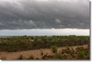
Weather Topic: What are Shelf Clouds?
Home - Education - Cloud Types - Shelf Clouds
 Next Topic: Sleet
A shelf cloud is similar to a wall cloud, but forms at the front
of a storm cloud, instead of at the rear, where wall clouds form.
A shelf cloud is caused by a series of events set into motion by the advancing
storm; first, cool air settles along the ground where precipitation has just fallen.
As the cool air is brought in, the warmer air is displaced, and rises above it,
because it is less dense. When the warmer air reaches the bottom of the storm cloud,
it begins to cool again, and the resulting condensation is a visible shelf cloud.
Next Topic: Sleet
Current conditions powered by WeatherAPI.com


