Weather Alert in California
Heat Advisory issued June 7 at 1:23PM PDT until June 9 at 11:00PM PDT by NWS Sacramento CA
AREAS AFFECTED: Shasta Lake Area / Northern Shasta County; Northern Sacramento Valley; Northeast Foothills/Sacramento Valley
DESCRIPTION: * WHAT...Hot temperatures 102 to 108 and areas of Major HeatRisk expected. Limited overnight relief with low temperatures in the low to mid 70s. * WHERE...Northeast Foothills, Northern Sacramento Valley, and Shasta Lake Area / Northern Shasta County. * WHEN...From 11 AM Sunday to 11 PM PDT Monday. * IMPACTS...Heat related illnesses increase significantly during extreme heat events, particularly for those working or participating in outdoor activities. * ADDITIONAL DETAILS...Area waterways continue to run cold and fast, creating dangerous conditions for those seeking relief in rivers and lakes.
INSTRUCTION: Drink plenty of fluids, stay in an air-conditioned room, stay out of the sun, and check up on relative and neighbors, especially those more susceptible to heat impacts.
Want more detail? Get the Complete 7 Day and Night Detailed Forecast!
Current U.S. National Radar--Current
The Current National Weather Radar is shown below with a UTC Time (subtract 5 hours from UTC to get Eastern Time).

National Weather Forecast--Current
The Current National Weather Forecast and National Weather Map are shown below.

National Weather Forecast for Tomorrow
Tomorrow National Weather Forecast and Tomorrow National Weather Map are show below.

North America Water Vapor (Moisture)
This map shows recent moisture content over North America. Bright and colored areas show high moisture (ie, clouds); brown indicates very little moisture present; black indicates no moisture.

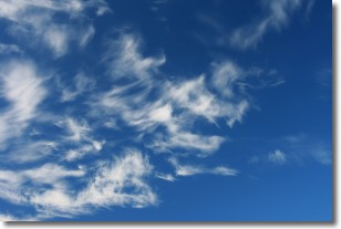
Weather Topic: What are Altostratus Clouds?
Home - Education - Cloud Types - Altostratus Clouds
 Next Topic: Cirrocumulus Clouds
Altostratus clouds form at mid to high-level altitudes
(between 2 and 7 km) and are created by a warm, stable air mass which causes
water vapor
to condense as it rise through the atmosphere. Usually altostratus clouds are
featureless sheets characterized by a uniform color.
In some cases, wind punching through the cloud formation may give it a waved
appearance, called altostratus undulatus. Altostratus clouds
are commonly seen with other cloud formations accompanying them.
Next Topic: Cirrocumulus Clouds
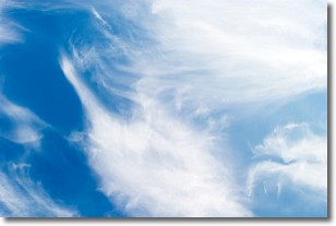
Weather Topic: What are Cirrostratus Clouds?
Home - Education - Cloud Types - Cirrostratus Clouds
 Next Topic: Cirrus Clouds
Cirrostratus clouds are high, thin clouds that form above
20,000 feet and are made mostly of ice crystals. They sometimes look like giant
feathers, horse tails, or curls of hair in the sky.
These clouds are pushed by the jet stream and can move at high speeds reaching
100 mph.
What do they indicate?
They indicate that a precipitation is likely within 24 hours.
Next Topic: Cirrus Clouds
Current conditions powered by WeatherAPI.com


