Weather Alert in California
Heat Advisory issued June 7 at 1:23PM PDT until June 9 at 11:00PM PDT by NWS Sacramento CA
AREAS AFFECTED: Shasta Lake Area / Northern Shasta County; Northern Sacramento Valley; Northeast Foothills/Sacramento Valley
DESCRIPTION: * WHAT...Hot temperatures 102 to 108 and areas of Major HeatRisk expected. Limited overnight relief with low temperatures in the low to mid 70s. * WHERE...Northeast Foothills, Northern Sacramento Valley, and Shasta Lake Area / Northern Shasta County. * WHEN...From 11 AM Sunday to 11 PM PDT Monday. * IMPACTS...Heat related illnesses increase significantly during extreme heat events, particularly for those working or participating in outdoor activities. * ADDITIONAL DETAILS...Area waterways continue to run cold and fast, creating dangerous conditions for those seeking relief in rivers and lakes.
INSTRUCTION: Drink plenty of fluids, stay in an air-conditioned room, stay out of the sun, and check up on relative and neighbors, especially those more susceptible to heat impacts.
Want more detail? Get the Complete 7 Day and Night Detailed Forecast!
Current U.S. National Radar--Current
The Current National Weather Radar is shown below with a UTC Time (subtract 5 hours from UTC to get Eastern Time).

National Weather Forecast--Current
The Current National Weather Forecast and National Weather Map are shown below.

National Weather Forecast for Tomorrow
Tomorrow National Weather Forecast and Tomorrow National Weather Map are show below.

North America Water Vapor (Moisture)
This map shows recent moisture content over North America. Bright and colored areas show high moisture (ie, clouds); brown indicates very little moisture present; black indicates no moisture.

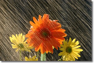
Weather Topic: What is Rain?
Home - Education - Precipitation - Rain
 Next Topic: Shelf Clouds
Precipitation in the form of water droplets is called rain.
Rain generally has a tendency to fall with less intensity over a greater period
of time, and when rainfall is more severe it is usually less sustained.
Rain is the most common form of precipitation and happens with greater frequency
depending on the season and regional influences. Cities have been shown to have
an observable effect on rainfall, due to an effect called the urban heat island.
Compared to upwind, monthly rainfall between twenty and forty miles downwind of
cities is 30% greater.
Next Topic: Shelf Clouds
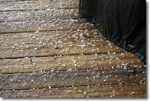
Weather Topic: What is Sleet?
Home - Education - Precipitation - Sleet
 Next Topic: Snow
Sleet is a form of precipitation in which small ice pellets are the primary
components. These ice pellets are smaller and more translucent than hailstones,
and harder than graupel. Sleet is caused by specific atmospheric conditions and
therefore typically doesn't last for extended periods of time.
The condition which leads to sleet formation requires a warmer body of air to be
wedged in between two sub-freezing bodies of air. When snow falls through a warmer
layer of air it melts, and as it falls through the next sub-freezing body of air
it freezes again, forming ice pellets known as sleet. In some cases, water
droplets don't have time to freeze before reaching the surface and the result is
freezing rain.
Next Topic: Snow
Current conditions powered by WeatherAPI.com


