Weather Alert in Louisiana
Tornado Watch issued February 14 at 11:17PM CST until February 15 at 2:00AM CST by NWS Jackson MS
AREAS AFFECTED: Catahoula, LA; Concordia, LA; East Carroll, LA; Franklin, LA; Madison, LA; Morehouse, LA; Richland, LA; Tensas, LA; West Carroll, LA; Adams, MS; Claiborne, MS; Copiah, MS; Franklin, MS; Hinds, MS; Issaquena, MS; Jefferson, MS; Lincoln, MS; Warren, MS
DESCRIPTION: TORNADO WATCH 6 REMAINS VALID UNTIL 2 AM CST SUNDAY FOR THE FOLLOWING AREAS IN LOUISIANA THIS WATCH INCLUDES 9 PARISHES IN NORTHEAST LOUISIANA CATAHOULA CONCORDIA EAST CARROLL FRANKLIN MADISON MOREHOUSE RICHLAND TENSAS WEST CARROLL IN MISSISSIPPI THIS WATCH INCLUDES 9 COUNTIES IN CENTRAL MISSISSIPPI COPIAH HINDS IN SOUTH CENTRAL MISSISSIPPI LINCOLN IN SOUTHWEST MISSISSIPPI ADAMS CLAIBORNE FRANKLIN JEFFERSON IN WEST CENTRAL MISSISSIPPI ISSAQUENA WARREN THIS INCLUDES THE CITIES OF BASTROP, BROOKHAVEN, BUDE, CRYSTAL SPRINGS, DELHI, EPPS, FAYETTE, FERRIDAY, HARRISONBURG, HAZLEHURST, JACKSON, JONESVILLE, LAKE PROVIDENCE, MAYERSVILLE, MEADVILLE, NATCHEZ, NEWELLTON, OAK GROVE, PORT GIBSON, RAYVILLE, ROXIE, ST. JOSEPH, TALLULAH, VICKSBURG, VIDALIA, WATERPROOF, WESSON, WEST FERRIDAY, AND WINNSBORO.
INSTRUCTION: N/A
Want more detail? Get the Complete 7 Day and Night Detailed Forecast!
Current U.S. National Radar--Current
The Current National Weather Radar is shown below with a UTC Time (subtract 5 hours from UTC to get Eastern Time).

National Weather Forecast--Current
The Current National Weather Forecast and National Weather Map are shown below.

National Weather Forecast for Tomorrow
Tomorrow National Weather Forecast and Tomorrow National Weather Map are show below.

North America Water Vapor (Moisture)
This map shows recent moisture content over North America. Bright and colored areas show high moisture (ie, clouds); brown indicates very little moisture present; black indicates no moisture.

Weather Topic: What are Cumulus Clouds?
Home - Education - Cloud Types - Cumulus Clouds
 Next Topic: Drizzle
Cumulus clouds are fluffy and textured with rounded tops, and
may have flat bottoms. The border of a cumulus cloud
is clearly defined, and can have the appearance of cotton or cauliflower.
Cumulus clouds form at low altitudes (rarely above 2 km) but can grow very tall,
becoming cumulus congestus and possibly the even taller cumulonimbus clouds.
When cumulus clouds become taller, they have a greater chance of producing precipitation.
Next Topic: Drizzle
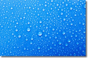
Weather Topic: What is Evaporation?
Home - Education - Precipitation - Evaporation
 Next Topic: Fog
Evaporation is the process which returns water from the earth
back to the atmosphere, and is another crucial process in the water cycle.
Evaporation is the transformation of liquid into gas, and it happens because
molecules are excited by the application of energy and turn into vapor.
In order for water to evaporate it has to be on the surface of a body of water.
Next Topic: Fog
Current conditions powered by WeatherAPI.com


