Weather Alert in Idaho
Winter Weather Advisory issued February 23 at 5:02PM MST until February 25 at 5:00PM MST by NWS Pocatello ID
AREAS AFFECTED: Sawtooth/Stanley Basin; Sun Valley Region; Big Lost Highlands/Copper Basin
DESCRIPTION: * WHAT...Moderate to heavy snow expected above 7000 feet. Total snow accumulations between 7 and 17 inches. Amounts exceeding 2 feet are possible across the Sawtooths. Winds gusts up to 35 mph are possible, peaking in excess of 45 mph Tuesday night and Wednesday morning. * WHERE...Big Lost Highlands/Copper Basin, Sawtooth/Stanley Basin, and Sun Valley Region. * WHEN...Until 5 PM MST Wednesday. * IMPACTS...Travel could be very difficult. Some blowing and drifting snow is expected, especially in exposed areas and higher ridgetops.
INSTRUCTION: Slow down and use caution while traveling. Call 5 1 1 or visit 511.idaho.gov for the latest road conditions.
Want more detail? Get the Complete 7 Day and Night Detailed Forecast!
Current U.S. National Radar--Current
The Current National Weather Radar is shown below with a UTC Time (subtract 5 hours from UTC to get Eastern Time).

National Weather Forecast--Current
The Current National Weather Forecast and National Weather Map are shown below.

National Weather Forecast for Tomorrow
Tomorrow National Weather Forecast and Tomorrow National Weather Map are show below.

North America Water Vapor (Moisture)
This map shows recent moisture content over North America. Bright and colored areas show high moisture (ie, clouds); brown indicates very little moisture present; black indicates no moisture.

Weather Topic: What are Cumulonimbus Clouds?
Home - Education - Cloud Types - Cumulonimbus Clouds
 Next Topic: Cumulus Clouds
The final form taken by a growing cumulus cloud is the
cumulonimbus cloud, which is very tall and dense.
The tower of a cumulonimbus cloud can soar 23 km into the atmosphere, although
most commonly they stop growing at an altitude of 6 km.
Even small cumulonimbus clouds appear very large in comparison to other cloud types.
They can signal the approach of stormy weather, such as thunderstorms or blizzards.
Next Topic: Cumulus Clouds
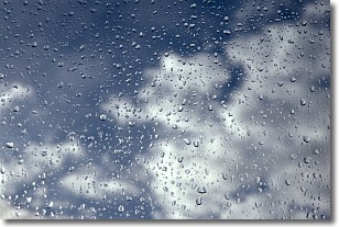
Weather Topic: What is Drizzle?
Home - Education - Precipitation - Drizzle
 Next Topic: Evaporation
Drizzle is precipitation in the form of water droplets which are
smaller than raindrops.
Drizzle is characterized by fine, gently falling droplets and typically does not
impact human habitation in a negative way. The exception to this is freezing drizzle,
a condition where drizzle freezes immediately upon reaching earth's surface.
Freezing drizzle is still less dangerous than freezing rain, but can
potentially result in hazardous road conditions.
Next Topic: Evaporation
Current conditions powered by WeatherAPI.com


