Weather Alert in Colorado
Flood Watch issued September 11 at 2:51AM MDT until September 13 at 12:00AM MDT by NWS Grand Junction CO
AREAS AFFECTED: Roan and Tavaputs Plateaus; Grand Valley; Debeque to Silt Corridor; Central Colorado River Basin; Grand and Battlement Mesas; Gore and Elk Mountains/Central Mountain Valleys; Central Gunnison and Uncompahgre River Basin; West Elk and Sawatch Mountains; Flat Tops; Upper Gunnison River Valley; Uncompahgre Plateau/Dallas Divide; Northwestern San Juan Mountains; Southwest San Juan Mountains; Paradox Valley/Lower Dolores River; Four Corners/Upper Dolores River; Animas River Basin; San Juan River Basin; Arches/Grand Flat; La Sal and Abajo Mountains
DESCRIPTION: * WHAT...Flash flooding caused by excessive rainfall continues to be possible. * WHERE...Portions of southwest and west-central Colorado, as well as portions of eastern Utah. Recent burn scars, including Deer Creek, Lee, Elk, South Rim, Turner Gulch, and Stoner Mesa, will be the most susceptible. * WHEN...From 6 AM MDT this morning through Friday evening. * IMPACTS...Excessive runoff from strong thunderstorms may result in debris flows and flooding of rivers, creeks, streams, and other low-lying and flood-prone locations. * ADDITIONAL DETAILS... - http://www.weather.gov/safety/flood
INSTRUCTION: You should monitor later forecasts and be prepared to take action should Flash Flood Warnings be issued.
Want more detail? Get the Complete 7 Day and Night Detailed Forecast!
Current U.S. National Radar--Current
The Current National Weather Radar is shown below with a UTC Time (subtract 5 hours from UTC to get Eastern Time).

National Weather Forecast--Current
The Current National Weather Forecast and National Weather Map are shown below.

National Weather Forecast for Tomorrow
Tomorrow National Weather Forecast and Tomorrow National Weather Map are show below.

North America Water Vapor (Moisture)
This map shows recent moisture content over North America. Bright and colored areas show high moisture (ie, clouds); brown indicates very little moisture present; black indicates no moisture.

Weather Topic: What are Cumulus Clouds?
Home - Education - Cloud Types - Cumulus Clouds
 Next Topic: Drizzle
Cumulus clouds are fluffy and textured with rounded tops, and
may have flat bottoms. The border of a cumulus cloud
is clearly defined, and can have the appearance of cotton or cauliflower.
Cumulus clouds form at low altitudes (rarely above 2 km) but can grow very tall,
becoming cumulus congestus and possibly the even taller cumulonimbus clouds.
When cumulus clouds become taller, they have a greater chance of producing precipitation.
Next Topic: Drizzle
Weather Topic: What is Evaporation?
Home - Education - Precipitation - Evaporation
 Next Topic: Fog
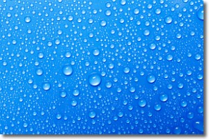
Evaporation is the process which returns water from the earth
back to the atmosphere, and is another crucial process in the water cycle.
Evaporation is the transformation of liquid into gas, and it happens because
molecules are excited by the application of energy and turn into vapor.
In order for water to evaporate it has to be on the surface of a body of water.
Next Topic: Fog
Current conditions powered by WeatherAPI.com


