Weather Alert in Alaska
Winter Storm Watch issued February 8 at 4:13PM AKST until February 10 at 6:00PM AKST by NWS Anchorage AK
AREAS AFFECTED: Kuskokwim Delta Coast and Nunivak Island
DESCRIPTION: * WHAT...Blizzard conditions possible with visibilities of one quarter mile or less. Total snow accumulations between 6 and 10 inches possible. Winds could gust as high as 45 mph. * WHERE...Kuskokwim Delta Coast and Nunivak Island. * WHEN...From late Monday night through Tuesday afternoon. * IMPACTS...Whiteout conditions are possible and may make travel treacherous and potentially life-threatening. Travel could be very difficult. * ADDITIONAL DETAILS...A Bering Sea low will bring heavy snow and strong winds resulting in times of whiteout conditions late Monday evening into late Tuesday afternoon.
INSTRUCTION: A Winter Storm Watch for blizzard conditions means there is a potential for falling and/or blowing snow with strong winds and extremely poor visibilities. This can lead to whiteout conditions and make travel very hazardous. Prepare for possible blizzard conditions. Continue to monitor the latest forecasts for updates on this situation. Persons should consider delaying all travel. If travel is absolutely necessary, use extreme caution. Consider taking a winter storm kit along with you, including such items as tire chains, booster cables, flashlight, shovel, blankets and extra clothing. Also take water, a first aid kit, and anything else that would help you survive in case you become stranded.
Want more detail? Get the Complete 7 Day and Night Detailed Forecast!
Current U.S. National Radar--Current
The Current National Weather Radar is shown below with a UTC Time (subtract 5 hours from UTC to get Eastern Time).

National Weather Forecast--Current
The Current National Weather Forecast and National Weather Map are shown below.

National Weather Forecast for Tomorrow
Tomorrow National Weather Forecast and Tomorrow National Weather Map are show below.

North America Water Vapor (Moisture)
This map shows recent moisture content over North America. Bright and colored areas show high moisture (ie, clouds); brown indicates very little moisture present; black indicates no moisture.

Weather Topic: What are Cumulonimbus Clouds?
Home - Education - Cloud Types - Cumulonimbus Clouds
 Next Topic: Cumulus Clouds
The final form taken by a growing cumulus cloud is the
cumulonimbus cloud, which is very tall and dense.
The tower of a cumulonimbus cloud can soar 23 km into the atmosphere, although
most commonly they stop growing at an altitude of 6 km.
Even small cumulonimbus clouds appear very large in comparison to other cloud types.
They can signal the approach of stormy weather, such as thunderstorms or blizzards.
Next Topic: Cumulus Clouds
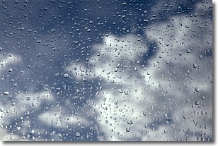
Weather Topic: What is Drizzle?
Home - Education - Precipitation - Drizzle
 Next Topic: Evaporation
Drizzle is precipitation in the form of water droplets which are
smaller than raindrops.
Drizzle is characterized by fine, gently falling droplets and typically does not
impact human habitation in a negative way. The exception to this is freezing drizzle,
a condition where drizzle freezes immediately upon reaching earth's surface.
Freezing drizzle is still less dangerous than freezing rain, but can
potentially result in hazardous road conditions.
Next Topic: Evaporation
Current conditions powered by WeatherAPI.com


