Weather Alert in Idaho
Avalanche Warning issued February 24 at 11:47AM MST by NWS Boise ID
AREAS AFFECTED: Adams, ID; Idaho, ID; Valley, ID
DESCRIPTION: The following message is transmitted at the request of the Payette National Forest Avalanche Center. ...The Payette National Forest Avalanche Center in McCall Idaho has issued a BACKCOUNTRY AVALANCHE WARNING... * WHAT...The avalanche danger for the West Central Mountains of Idaho will rise to HIGH on Tuesday afternoon and into Wednesday morning. Rain on snow and heavy, wet snow will create very dangerous avalanche conditions. * WHERE...The West Central Mountains of Idaho, including mountains near the communities of McCall, New Meadows, Donnelly, Cascade, and Yellow Pine. * WHEN...In effect from Tuesday 11:25 MST to Wednesday 11:45 MST. * IMPACTS...A warm, wet storm is bringing wet, heavy snowfall and rising rain levels up to 7000'. Natural and human-triggered avalanches large enough to bury people are very likely to occur. Even smaller steep slopes, like roadcuts, may also avalanche, depositing a surprising amount of debris on the road below.
INSTRUCTION: *Travel on or underneath slopes steeper than 30 degrees is not recommended. Avalanches may run onto groomed snowmobile trails. Pay attention to the terrain above you as conditions change and as more snow and rain fall by the afternoon. Avalanches may impact roadways along the South Fork of the Salmon, Warm Lake Summit, and East Fork South Fork. Consult WWW.PAYETTEAVALANCHE.ORG or WWW.AVALANCHE.ORG for more detailed information. Similar avalanche danger may exist at locations outside the coverage area of this or any avalanche center. LAT...LON 4491 11627 4497 11622 4488 11606 4440 11601 4429 11609 4431 11620 4439 11626 4461 11628 4468 11635 4479 11634 4485 11626
Want more detail? Get the Complete 7 Day and Night Detailed Forecast!
Current U.S. National Radar--Current
The Current National Weather Radar is shown below with a UTC Time (subtract 5 hours from UTC to get Eastern Time).

National Weather Forecast--Current
The Current National Weather Forecast and National Weather Map are shown below.

National Weather Forecast for Tomorrow
Tomorrow National Weather Forecast and Tomorrow National Weather Map are show below.

North America Water Vapor (Moisture)
This map shows recent moisture content over North America. Bright and colored areas show high moisture (ie, clouds); brown indicates very little moisture present; black indicates no moisture.

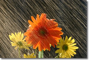
Weather Topic: What is Rain?
Home - Education - Precipitation - Rain
 Next Topic: Shelf Clouds
Precipitation in the form of water droplets is called rain.
Rain generally has a tendency to fall with less intensity over a greater period
of time, and when rainfall is more severe it is usually less sustained.
Rain is the most common form of precipitation and happens with greater frequency
depending on the season and regional influences. Cities have been shown to have
an observable effect on rainfall, due to an effect called the urban heat island.
Compared to upwind, monthly rainfall between twenty and forty miles downwind of
cities is 30% greater.
Next Topic: Shelf Clouds
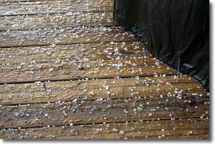
Weather Topic: What is Sleet?
Home - Education - Precipitation - Sleet
 Next Topic: Snow
Sleet is a form of precipitation in which small ice pellets are the primary
components. These ice pellets are smaller and more translucent than hailstones,
and harder than graupel. Sleet is caused by specific atmospheric conditions and
therefore typically doesn't last for extended periods of time.
The condition which leads to sleet formation requires a warmer body of air to be
wedged in between two sub-freezing bodies of air. When snow falls through a warmer
layer of air it melts, and as it falls through the next sub-freezing body of air
it freezes again, forming ice pellets known as sleet. In some cases, water
droplets don't have time to freeze before reaching the surface and the result is
freezing rain.
Next Topic: Snow
Current conditions powered by WeatherAPI.com


