Weather Alert in Nebraska
Flood Advisory issued February 8 at 10:15PM CST until February 9 at 7:00PM CST by NWS Hastings NE
AREAS AFFECTED: Hall, NE; Hamilton, NE; Merrick, NE
DESCRIPTION: * WHAT...Flooding caused by an ice jam is expected. * WHERE...Portions of central and south central Nebraska, including the following counties, in central Nebraska, Merrick. In south central Nebraska, Hall and Hamilton. * WHEN...Until 700 PM CST Monday. * IMPACTS...Minor flooding in low-lying areas along the Platte River. * ADDITIONAL DETAILS... - At 1009 PM CST, National Weather Service personnel and the public reported an ice jam within some of the channels of the Platte River in the vicinity of Highway 281 and Locust Street in Hall County. Minor flooding is already occurring. - Some locations that will experience flooding include... Low lying areas adjacent to the Platte River in rural Hall, Hamilton, and Merrick Counties.
INSTRUCTION: Turn around, don't drown when encountering flooded roads. Most flood deaths occur in vehicles. Be aware of your surroundings and do not drive on flooded roads.
Want more detail? Get the Complete 7 Day and Night Detailed Forecast!
Current U.S. National Radar--Current
The Current National Weather Radar is shown below with a UTC Time (subtract 5 hours from UTC to get Eastern Time).

National Weather Forecast--Current
The Current National Weather Forecast and National Weather Map are shown below.

National Weather Forecast for Tomorrow
Tomorrow National Weather Forecast and Tomorrow National Weather Map are show below.

North America Water Vapor (Moisture)
This map shows recent moisture content over North America. Bright and colored areas show high moisture (ie, clouds); brown indicates very little moisture present; black indicates no moisture.

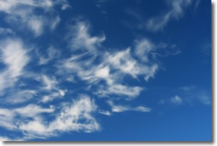
Weather Topic: What are Altostratus Clouds?
Home - Education - Cloud Types - Altostratus Clouds
 Next Topic: Cirrocumulus Clouds
Altostratus clouds form at mid to high-level altitudes
(between 2 and 7 km) and are created by a warm, stable air mass which causes
water vapor
to condense as it rise through the atmosphere. Usually altostratus clouds are
featureless sheets characterized by a uniform color.
In some cases, wind punching through the cloud formation may give it a waved
appearance, called altostratus undulatus. Altostratus clouds
are commonly seen with other cloud formations accompanying them.
Next Topic: Cirrocumulus Clouds
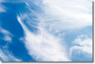
Weather Topic: What are Cirrostratus Clouds?
Home - Education - Cloud Types - Cirrostratus Clouds
 Next Topic: Cirrus Clouds
Cirrostratus clouds are high, thin clouds that form above
20,000 feet and are made mostly of ice crystals. They sometimes look like giant
feathers, horse tails, or curls of hair in the sky.
These clouds are pushed by the jet stream and can move at high speeds reaching
100 mph.
What do they indicate?
They indicate that a precipitation is likely within 24 hours.
Next Topic: Cirrus Clouds
Current conditions powered by WeatherAPI.com


