Weather Alert in Alaska
Winter Weather Advisory issued August 25 at 7:58PM AKDT until August 28 at 7:00AM AKDT by NWS Fairbanks AK
AREAS AFFECTED: Central Beaufort Sea Coast; Central Arctic Plains; Central Brooks Range
DESCRIPTION: * WHAT...Mixed precipitation expected. Total snow accumulations up to 2 inch inches north of the Brooks Range and up to 1 inch in the Brooks Range and ice accumulations around a light glaze. * WHERE...Central Arctic Plains, Central Beaufort Sea Coast, and Central Brooks Range. * WHEN...From 10 PM Tuesday to 7 AM AKDT Thursday. * IMPACTS...Plan on slippery road conditions. Any accumulating snow and freezing rain could create difficult travel conditions. * ADDITIONAL DETAILS...There is very high uncertainty in exact accumulations. Freezing rain is possible everywhere, especially in the Brooks Range and along the Dalton Highway south of Prudhoe Bay. Temperatures will hover around 32 degrees, especially Tuesday night and Wednesday night which will make things difficult to accumulate unless precipitation rates are heavy enough to overcome warm ground temperatures. The greatest risk for accumulating snow will be north of the Brooks Range and towards the coast, while the greatest risk for freezing rain accumulations resides in the Brooks Range. The Dalton Highway in between has equal chances for both.
INSTRUCTION: Slow down and use caution while traveling. The latest road conditions for the state you are calling from can be obtained by calling 5 1 1.
Want more detail? Get the Complete 7 Day and Night Detailed Forecast!
Current U.S. National Radar--Current
The Current National Weather Radar is shown below with a UTC Time (subtract 5 hours from UTC to get Eastern Time).

National Weather Forecast--Current
The Current National Weather Forecast and National Weather Map are shown below.

National Weather Forecast for Tomorrow
Tomorrow National Weather Forecast and Tomorrow National Weather Map are show below.

North America Water Vapor (Moisture)
This map shows recent moisture content over North America. Bright and colored areas show high moisture (ie, clouds); brown indicates very little moisture present; black indicates no moisture.

Weather Topic: What are Cumulus Clouds?
Home - Education - Cloud Types - Cumulus Clouds
 Next Topic: Drizzle
Cumulus clouds are fluffy and textured with rounded tops, and
may have flat bottoms. The border of a cumulus cloud
is clearly defined, and can have the appearance of cotton or cauliflower.
Cumulus clouds form at low altitudes (rarely above 2 km) but can grow very tall,
becoming cumulus congestus and possibly the even taller cumulonimbus clouds.
When cumulus clouds become taller, they have a greater chance of producing precipitation.
Next Topic: Drizzle
Weather Topic: What is Evaporation?
Home - Education - Precipitation - Evaporation
 Next Topic: Fog
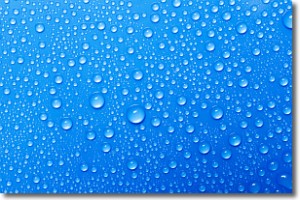
Evaporation is the process which returns water from the earth
back to the atmosphere, and is another crucial process in the water cycle.
Evaporation is the transformation of liquid into gas, and it happens because
molecules are excited by the application of energy and turn into vapor.
In order for water to evaporate it has to be on the surface of a body of water.
Next Topic: Fog
Current conditions powered by WeatherAPI.com


