Weather Alert in California
Winter Storm Watch issued February 14 at 12:20PM PST until February 19 at 9:00AM PST by NWS Los Angeles/Oxnard CA
AREAS AFFECTED: Northern Ventura County Mountains; Eastern San Gabriel Mountains
DESCRIPTION: * WHAT...Heavy snow possible. Total snow accumulations of 1 to 4 inches for 3500 to 4500 feet elevation possible, 6 to 12 inches for 4500 to 6000 feet elevation possible, and one to two feet above 6000 feet elevation possible. Wind gusts of 60 to 70 mph through Monday afternoon possible, and as high as 50 mph through Thursday morning possible. * WHERE...Eastern San Gabriel Mountains and Northern Ventura County Mountains. * WHEN...From Monday morning through Thursday morning. * IMPACTS...Roads, and especially bridges and overpasses, will likely become slick and hazardous. Travel could become treacherous. Visibilities may drop below one-quarter mile due to falling and blowing snow. Damaging winds could blow down trees and power lines. * ADDITIONAL DETAILS...There will be a break in the snowfall for Tuesday into Tuesday night, before heavy snow returns by Wednesday. However, blowing and drifting snow producing significant visibility restrictions will continue above 6000 feet elevation, even during the break in snowfall.
INSTRUCTION: Monitor the latest forecasts for updates on this situation. If travel is absolutely necessary, drive with extreme caution and be prepared for sudden changes in visibility. Leave plenty of room between you and the motorist ahead of you, and allow extra time to reach your destination. Avoid sudden braking or acceleration, and be especially cautious on hills or when making turns. Make sure your car is winterized and in good working order. Damaging winds could blow down trees and power lines. Travel could be difficult, especially for high profile vehicles.
Want more detail? Get the Complete 7 Day and Night Detailed Forecast!
Current U.S. National Radar--Current
The Current National Weather Radar is shown below with a UTC Time (subtract 5 hours from UTC to get Eastern Time).

National Weather Forecast--Current
The Current National Weather Forecast and National Weather Map are shown below.

National Weather Forecast for Tomorrow
Tomorrow National Weather Forecast and Tomorrow National Weather Map are show below.

North America Water Vapor (Moisture)
This map shows recent moisture content over North America. Bright and colored areas show high moisture (ie, clouds); brown indicates very little moisture present; black indicates no moisture.

Weather Topic: What is Evaporation?
Home - Education - Precipitation - Evaporation
 Next Topic: Fog
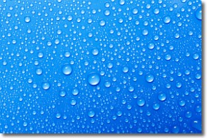
Evaporation is the process which returns water from the earth
back to the atmosphere, and is another crucial process in the water cycle.
Evaporation is the transformation of liquid into gas, and it happens because
molecules are excited by the application of energy and turn into vapor.
In order for water to evaporate it has to be on the surface of a body of water.
Next Topic: Fog
Weather Topic: What are Fractus Clouds?
Home - Education - Cloud Types - Fractus Clouds
 Next Topic: Freezing Rain
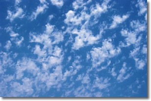
A fractus cloud (scud) is a fragmented, tattered cloud which has
likely been sheared off of another cloud. They are accessory clouds, meaning they
develop from parent clouds, and are named in a way which describes the original
cloud which contained them.
Fractus clouds which have originated from cumulus clouds are referred to as
cumulus fractus, while fractus clouds which have originated from stratus clouds
are referred to as stratus fractus. Under certain conditions a fractus cloud might
merge with another cloud, or develop into a cumulus cloud, but usually a
fractus cloud seen by itself will dissipate rapidly.
They are often observed on the leading and trailing edges of storm clouds,
and are a display of wind activity.
Next Topic: Freezing Rain
Current conditions powered by WeatherAPI.com


