Weather Alert in Oregon
Winter Weather Advisory issued March 31 at 10:42AM PDT until April 2 at 11:00AM PDT by NWS Medford OR
AREAS AFFECTED: Klamath Basin; Northern and Eastern Klamath County and Western Lake County
DESCRIPTION: * WHAT...Snow and gusty winds expected. Total snow accumulations 3 to 6 inches. Winds gusts up to 25 mph at lower elevations with gusts up to 45 mph over higher terrain are expected. * WHERE...Northern Klamath Basin, northern and eastern Klamath County and far western Lake County. This includes Highway 97 from Modoc Point northward and the higher portions of Highway 140 between Bly and Lakeview. This includes the communities of Chiloquin, Chemult, and Crescent and the higher terrain in eastern Klamath and western Lake counties. * WHEN...From 5 PM Wednesday to 11 AM PDT Thursday. * IMPACTS...Travel may be difficult and delays in your commute. The hazardous conditions could impact the Wednesday evening and Thursday morning commutes. Gusty winds could bring down tree branches.
INSTRUCTION: Slow down and use caution while traveling. Call 511 or visit tripcheck.com for road information.
Want more detail? Get the Complete 7 Day and Night Detailed Forecast!
Current U.S. National Radar--Current
The Current National Weather Radar is shown below with a UTC Time (subtract 5 hours from UTC to get Eastern Time).

National Weather Forecast--Current
The Current National Weather Forecast and National Weather Map are shown below.

National Weather Forecast for Tomorrow
Tomorrow National Weather Forecast and Tomorrow National Weather Map are show below.

North America Water Vapor (Moisture)
This map shows recent moisture content over North America. Bright and colored areas show high moisture (ie, clouds); brown indicates very little moisture present; black indicates no moisture.

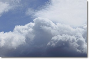
Weather Topic: What are Nimbostratus Clouds?
Home - Education - Cloud Types - Nimbostratus Clouds
 Next Topic: Precipitation
A nimbostratus cloud is similar to a stratus cloud in its formless,
smooth appearance. However, a nimbostratus cloud is darker than a stratus cloud,
because it is thicker.
Unlike a stratus cloud, a nimbostratus cloud typically brings with it the threat
of moderate to heavy precipitation. In some cases, the precipitation may evaporate
before reaching the ground, a phenomenon known as virga.
Next Topic: Precipitation
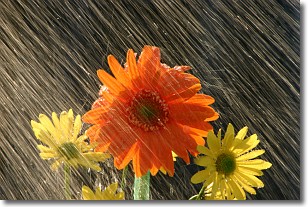
Weather Topic: What is Rain?
Home - Education - Precipitation - Rain
 Next Topic: Shelf Clouds
Precipitation in the form of water droplets is called rain.
Rain generally has a tendency to fall with less intensity over a greater period
of time, and when rainfall is more severe it is usually less sustained.
Rain is the most common form of precipitation and happens with greater frequency
depending on the season and regional influences. Cities have been shown to have
an observable effect on rainfall, due to an effect called the urban heat island.
Compared to upwind, monthly rainfall between twenty and forty miles downwind of
cities is 30% greater.
Next Topic: Shelf Clouds
Current conditions powered by WeatherAPI.com


